
IMAGES TAKEN NEAR TO
Westfield Villas, DONCASTER, DN7 6QA
Introduction
This page details the photographs taken nearby to Westfield Villas, DN7 6QA by members of the Geograph project.
The Geograph project started in 2005 with the aim of publishing, organising and preserving representative images for every square kilometre of Great Britain, Ireland and the Isle of Man.

There are currently over 7.5m images from over14,400 individuals and you can help contribute to the project by visiting https://www.geograph.org.uk
Image Map
Images are licensed for reuse under creativecommons.org/licenses/by-sa/2.0
Notes
- Clicking on the map will re-center to the selected point.
- The higher the marker number, the further away the image location is from the centre of the postcode.
Image Listing (59 Images Found)
Images are licensed for reuse under creativecommons.org/licenses/by-sa/2.0
Image
Details
Distance
1
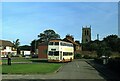
Hatfield bus turnround ? 1978
Compare with the same location in 2010 https://www.geograph.org.uk/photo/1709151 .
The bus is South Yorkshire PTE 1209, formerly Doncaster Corporation 209, a Daimler Fleetline new in 1967, operating on the service from Doncaster to Dunscroft which the PTE, as successor to Doncaster Corporation, shared with a number of small independent operators.
This is one of a series of views featuring buses in the 60s, 70s, and 80s. http://www.geograph.org.uk/search.php?i=137652761
Image: © Alan Murray-Rust
Taken: 14 Sep 1978
0.03 miles
2
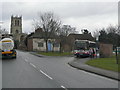
Hatfield bus terminus
The long-standing terminus of buses from Doncaster at Westfield Villas. Up until the early 70s this route was provided by a variety of local operators with a colourful selection of buses.
Image: © Alan Murray-Rust
Taken: 8 Feb 2010
0.03 miles

4
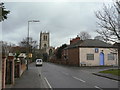
Station Road, Hatfield
The church with its perpendicular exterior stands impressively above the older part of the village.
Image: © Alan Murray-Rust
Taken: 8 Feb 2010
0.06 miles
6
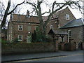
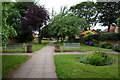
Church Lodge
An early 18th century house, opposite Hatfield Church. The stone above the door carries the date 1711.
Image: © Alan Murray-Rust
Taken: 8 Feb 2010
0.08 miles
7
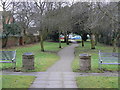
Dr Waters Gardens (1)
A former burial ground converted by the Hatfield Parish Council into a garden an named after the local doctor (see http://www.geograph.org.uk/photo/1709140).
Image: © Alan Murray-Rust
Taken: 8 Feb 2010
0.08 miles
8
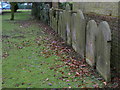
Dr Waters Gardens (3)
Former gravestones lined up along one wall of the garden. See http://www.geograph.org.uk/photo/1709137 .
Image: © Alan Murray-Rust
Taken: 8 Feb 2010
0.08 miles
9
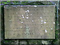
Dr Waters Gardens (2)
The commemorative plaque is self explanatory. See http://www.geograph.org.uk/photo/1709137 .
Image: © Alan Murray-Rust
Taken: 8 Feb 2010
0.08 miles
10
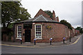
Handgelic Nails & Beauty, Station Road, Hatfield
Image: © Ian S
Taken: 6 Jun 2018
0.08 miles