
IMAGES TAKEN NEAR TO
Station Road, DONCASTER, DN7 6PY
Introduction
This page details the photographs taken nearby to Station Road, DN7 6PY by members of the Geograph project.
The Geograph project started in 2005 with the aim of publishing, organising and preserving representative images for every square kilometre of Great Britain, Ireland and the Isle of Man.

There are currently over 7.5m images from over14,400 individuals and you can help contribute to the project by visiting https://www.geograph.org.uk
Image Map
Images are licensed for reuse under creativecommons.org/licenses/by-sa/2.0
Notes
- Clicking on the map will re-center to the selected point.
- The higher the marker number, the further away the image location is from the centre of the postcode.
Image Listing (60 Images Found)
Images are licensed for reuse under creativecommons.org/licenses/by-sa/2.0
Image
Details
Distance
1
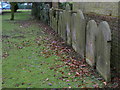
Dr Waters Gardens (3)
Former gravestones lined up along one wall of the garden. See http://www.geograph.org.uk/photo/1709137 .
Image: © Alan Murray-Rust
Taken: 8 Feb 2010
0.00 miles
2
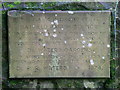
Dr Waters Gardens (2)
The commemorative plaque is self explanatory. See http://www.geograph.org.uk/photo/1709137 .
Image: © Alan Murray-Rust
Taken: 8 Feb 2010
0.00 miles
3
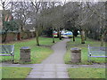
Dr Waters Gardens (1)
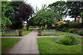
A former burial ground converted by the Hatfield Parish Council into a garden an named after the local doctor (see http://www.geograph.org.uk/photo/1709140).
Image: © Alan Murray-Rust
Taken: 8 Feb 2010
0.00 miles
4
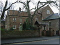
Church Lodge
An early 18th century house, opposite Hatfield Church. The stone above the door carries the date 1711.
Image: © Alan Murray-Rust
Taken: 8 Feb 2010
0.01 miles
7
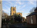
St. Lawrence's church seen from Station Road
Image: © Jonathan Thacker
Taken: 6 Dec 2014
0.03 miles
8
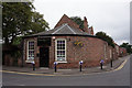
Handgelic Nails & Beauty, Station Road, Hatfield
Image: © Ian S
Taken: 6 Jun 2018
0.03 miles
9
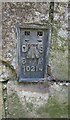
Ordnance Survey Flush Bracket (10214)
This OS Flush Bracket can be found on the north face of the St Lawrence's Church. It marks a point 7.555m above mean sea level.
Image: © Adrian Dust
Taken: 24 May 2016
0.04 miles
10
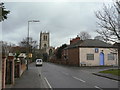
Station Road, Hatfield
The church with its perpendicular exterior stands impressively above the older part of the village.
Image: © Alan Murray-Rust
Taken: 8 Feb 2010
0.04 miles