IMAGES TAKEN NEAR TO
New Mill Field Road, DONCASTER, DN7 6PW
Introduction
This page details the photographs taken nearby to New Mill Field Road, DN7 6PW by members of the Geograph project.
The Geograph project started in 2005 with the aim of publishing, organising and preserving representative images for every square kilometre of Great Britain, Ireland and the Isle of Man.

There are currently over 7.5m images from over14,400 individuals and you can help contribute to the project by visiting https://www.geograph.org.uk
Image Map
Images are licensed for reuse under creativecommons.org/licenses/by-sa/2.0
Notes
- Clicking on the map will re-center to the selected point.
- The higher the marker number, the further away the image location is from the centre of the postcode.
Image Listing (15 Images Found)
Images are licensed for reuse under creativecommons.org/licenses/by-sa/2.0
Image
Details
Distance
1
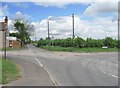
Dodgy crossroads.
Mosscroft Lane narrows abruptly after its junction with Ancient Lane and New Mill Field Road. Views for emerging traffic from New Mill Field Road are restricted.
Image: © Oxana Maher
Taken: 8 May 2007
0.08 miles
2
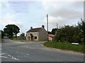
Crossroads near Hatfield Woodhouse
Pictured from Ancient Lane.
Image: © Jonathan Clitheroe
Taken: 30 May 2016
0.08 miles
3
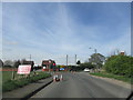
Road junction.
Ancient lane Hatfield Woodhouse/West End.
Image: © steven ruffles
Taken: 3 Apr 2017
0.09 miles
4
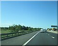
Flat area with banking alongside the M18 southbound (2)
The flat area with a high embankment could have been worked out sand and gravel pits now forming a flood alleviation roll?
Image: © Martin Dawes
Taken: 19 May 2021
0.10 miles
5
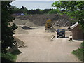
Sand and gravel pit, New Mill Field Road
According to the locals, this pit has been in the process of being closed for years, but work seems to be going on as usual!
Image: © Oxana Maher
Taken: 8 May 2007
0.14 miles
6
Old sand and gravel pit by M18
The disused windmill in the background is in a different square.
Image: © N Chadwick
Taken: 3 Jan 2017
0.14 miles
7
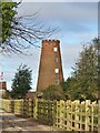
Tower Mill at Mill House
A grade II listed building dating from the early 19th century.
Image: © Graham Hogg
Taken: 20 Jan 2023
0.17 miles
8
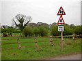
Risk of Ice
On Moss Croft Lane, nearing West End.
Image: © Steve Fareham
Taken: 11 Apr 2009
0.19 miles
9

Springtime in Hatfield Woodhouse
A mass of spring blossom along Ancient Lane.
Image: © Steve Fareham
Taken: 11 Apr 2009
0.20 miles