
IMAGES TAKEN NEAR TO
Roseberry Avenue, DONCASTER, DN7 6LF
Introduction
This page details the photographs taken nearby to Roseberry Avenue, DN7 6LF by members of the Geograph project.
The Geograph project started in 2005 with the aim of publishing, organising and preserving representative images for every square kilometre of Great Britain, Ireland and the Isle of Man.

There are currently over 7.5m images from over14,400 individuals and you can help contribute to the project by visiting https://www.geograph.org.uk
Image Map
Images are licensed for reuse under creativecommons.org/licenses/by-sa/2.0
Notes
- Clicking on the map will re-center to the selected point.
- The higher the marker number, the further away the image location is from the centre of the postcode.
Image Listing (6 Images Found)
Images are licensed for reuse under creativecommons.org/licenses/by-sa/2.0
Image
Details
Distance
1
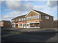
All you need for an evening in
These shops sell T.V.s, takeaways and comfy chairs. Sorted!
Image: © Jonathan Thacker
Taken: 30 Dec 2012
0.11 miles
2
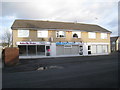
Cakes, tans and blow-dries
Shops on Ash Hill Crescent.
Image: © Jonathan Thacker
Taken: 30 Dec 2012
0.15 miles
3
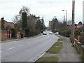
Station Road, Hatfield
Where I am standing would originally have been in the hamlet of Dunscroft, a name which is now applied to the housing development to the south west of Hatfield village. Housing is continuous so it is difficult to know where the boundary really lies.
Image: © Alan Murray-Rust
Taken: 8 Feb 2010
0.21 miles
5
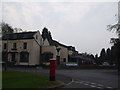
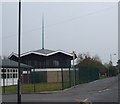
Hatfields Restaurant and Ash Hill Road Junction
Image: © Glyn Drury
Taken: 15 Apr 2009
0.25 miles
6
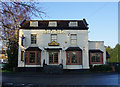
Hatfields, Hatfield
http://www.geograph.org.uk/photo/5688523
Image: © Ian S
Taken: 22 Feb 2018
0.25 miles