
IMAGES TAKEN NEAR TO
South Bramwith, Stainforth, DONCASTER, DN7 5SJ
Introduction
This page details the photographs taken nearby to DN7 5SJ by members of the Geograph project.
The Geograph project started in 2005 with the aim of publishing, organising and preserving representative images for every square kilometre of Great Britain, Ireland and the Isle of Man.

There are currently over 7.5m images from over14,400 individuals and you can help contribute to the project by visiting https://www.geograph.org.uk
Image Map
Images are licensed for reuse under creativecommons.org/licenses/by-sa/2.0
Notes
- Clicking on the map will re-center to the selected point.
- The higher the marker number, the further away the image location is from the centre of the postcode.
Image Listing (63 Images Found)
Images are licensed for reuse under creativecommons.org/licenses/by-sa/2.0
Image
Details
Distance
1
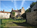
Fox Farm, South Bramwith
The farm buildings are derelict and the house seems to be unoccupied.
Image: © Jonathan Thacker
Taken: 7 Oct 2012
0.03 miles
2
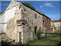
Farm buildings at South Bramwith
In poor condition and variously built from local magnesian limestone or brick. Each building is independent of the other hence the three sets of stairs to upper granaries. The centre brick building is listed http://www.britishlistedbuildings.co.uk/en-334654-cartshed-granary-approximately-12-metres
Image: © Jonathan Thacker
Taken: 7 Oct 2012
0.04 miles
3
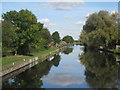
Sheffield and South Yorkshire Navigation at Bramwith Bridge
Fishing match in progress.
Image: © Jonathan Thacker
Taken: 7 Oct 2012
0.04 miles
4
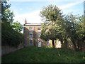
Fox Farm, South Bramwith (2)
The house appears to be unoccupied.
Image: © Jonathan Thacker
Taken: 7 Oct 2012
0.04 miles

6

Barn at Fox Farm, South Bramwith
A listed building http://www.britishlistedbuildings.co.uk/en-334655-l-shaped-barn-range-at-fox-farm-situated
Image: © Jonathan Thacker
Taken: 7 Oct 2012
0.04 miles
7
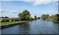
The River Dun Navigation, South Bramwith
Looking north-east, towards Stainforth.
Image: © Christine Johnstone
Taken: 30 Sep 2016
0.04 miles
8
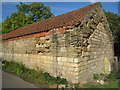
Barn at South Bramwith
At some time this barn has been heightened using inferior stone which has since suffered from extensive erosion.
Image: © Jonathan Thacker
Taken: 7 Oct 2012
0.05 miles
9
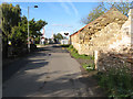
Approaching Bramwith Swing-bridge
Barriers and lights controlling the road traffic at the swing-bridge can be seen along the lane which passes derelict agricultural buildings. It is a great disappointment to see such fine old buildings, built with local Carboniferous sandstone falling into disrepair, although the extension of this barn clearly employed inferior material.
Image: © Jonathan Wilkins
Taken: 28 Oct 2011
0.06 miles
10
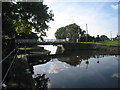
Bramwith Swing Bridge
Over the Sheffield and South Yorkshire Navigation.
Image: © Jonathan Thacker
Taken: 7 Oct 2012
0.07 miles