IMAGES TAKEN NEAR TO
Snelsholme Lane, DONCASTER, DN7 5LU
Introduction
This page details the photographs taken nearby to Snelsholme Lane, DN7 5LU by members of the Geograph project.
The Geograph project started in 2005 with the aim of publishing, organising and preserving representative images for every square kilometre of Great Britain, Ireland and the Isle of Man.

There are currently over 7.5m images from over14,400 individuals and you can help contribute to the project by visiting https://www.geograph.org.uk
Image Map
Images are licensed for reuse under creativecommons.org/licenses/by-sa/2.0
Notes
- Clicking on the map will re-center to the selected point.
- The higher the marker number, the further away the image location is from the centre of the postcode.
Image Listing (9 Images Found)
Images are licensed for reuse under creativecommons.org/licenses/by-sa/2.0
Image
Details
Distance
1
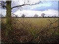
Sheep near Hazelhurst farm.
Very flat landscape.
Image: © steven ruffles
Taken: 16 Feb 2010
0.10 miles
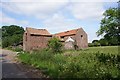
2

Geeseness Lane (Track)
Hazelhurst Farm to the left
Image: © Martin Dawes
Taken: 29 Feb 2012
0.11 miles
4

Sorrell Lane looking east
From opposite Weathercock Farm
Image: © Martin Dawes
Taken: 29 Feb 2012
0.13 miles
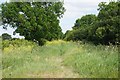
5
Geeseness Lane
At the junction with Wood Lane.
Image: © Jonathan Thacker
Taken: 27 Jan 2012
0.18 miles
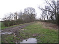
9
Wood Lane
A lane that was very wet beside the well filled ditch
Image: © Chris Morgan
Taken: 15 Dec 2014
0.25 miles