IMAGES TAKEN NEAR TO
Pinfold Lane, DONCASTER, DN7 5JS
Introduction
This page details the photographs taken nearby to Pinfold Lane, DN7 5JS by members of the Geograph project.
The Geograph project started in 2005 with the aim of publishing, organising and preserving representative images for every square kilometre of Great Britain, Ireland and the Isle of Man.

There are currently over 7.5m images from over14,400 individuals and you can help contribute to the project by visiting https://www.geograph.org.uk
Image Map
Images are licensed for reuse under creativecommons.org/licenses/by-sa/2.0
Notes
- Clicking on the map will re-center to the selected point.
- The higher the marker number, the further away the image location is from the centre of the postcode.
Image Listing (36 Images Found)
Images are licensed for reuse under creativecommons.org/licenses/by-sa/2.0
Image
Details
Distance
1
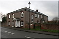
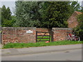
Zion House and Pinfold
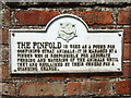
A stone dates the house to 183(7)? The Pinfold was used as a pound for confining stray animals. It was managed by an annually appointed keeper called the pinder, who was responsible for feeding and watering the animals. A toll was exacted for their return. The position of pinder was maintained until 1929.
Image: © Graham Hogg
Taken: 15 Dec 2014
0.05 miles
4
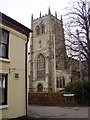
St Cuthberts Fishlake.
Village church stands next to the village pub.
Image: © steven ruffles
Taken: 14 Feb 2010
0.07 miles
5
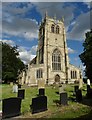
St Cuthbert's Church, Fishlake
This fine village church with Saxon and Norman elements is dedicated to St Cuthbert whose carved image can be seen in the apse three quarters of the way up the tower. Following the Viking invasion of Northumbria, Cuthbert's remains were removed from Lindisfarne and spent the next seven years being moved between various churches in the north of England. Fishlake is reputedly one of those churches.
Image: © Neil Theasby
Taken: 2 Jun 2015
0.09 miles
6
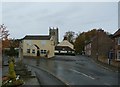
Centre of Fishlake Village
Much history is condensed into this quiet corner of South Yorkshire. Cluniac monks fleeing the invading Vikings are said to have disembarked here from Holy Island carrying valuables and the body of Saint Cuthbert after whom the church is named. They alighted at The Landing (situated to the right of this photo) which towards the end of the medieval period developed into an inland port. There is still a 'Custom House' in the village and 'The Old Anchor Inn' (currently staffed by an effervescent South African landlord) backing onto the Landing and the Stainforth Canal beyond. The celebrated Dutch drainage engineer Cornelius Vermuyden is also associated with this area although his work on nearby Hatfield Chase had a detrimental effect on Fishlake where river straightening led to flooding both here and in Sykehouse and Snaith.
Also worth seeking out in the village are the windmills and the 'butter crosses' one of which can be seen on this picture. They may be the remnants of Saxon preaching crosses which later evolved into market crosses selling produce including in this area - eels. A stone river marker on the Landing also survives giving the nautical distance to Tinsley near Sheffield along the canal.
The Norman porch at the church's southern entrance should also be seen. It was described by Pevsner as "perhaps the most lavishly decorated in Yorkshire".
Image: © Jonathan Clitheroe
Taken: 24 Oct 2015
0.09 miles
7
Ordnance Survey 1GL Bolt
This OS cut mark can be found on the west face of St Cuthbert's Church. It marks a point 6.700m above mean sea level.
Image: © Adrian Dust
Taken: 24 May 2016
0.09 miles
8
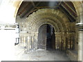
Fishlake - St Cuthbert's Church, Norman south door
Image: © Colin Park
Taken: 12 Aug 2019
0.10 miles