
IMAGES TAKEN NEAR TO
Ramskir Lane, DONCASTER, DN7 5BE
Introduction
This page details the photographs taken nearby to Ramskir Lane, DN7 5BE by members of the Geograph project.
The Geograph project started in 2005 with the aim of publishing, organising and preserving representative images for every square kilometre of Great Britain, Ireland and the Isle of Man.

There are currently over 7.5m images from over14,400 individuals and you can help contribute to the project by visiting https://www.geograph.org.uk
Image Map
Images are licensed for reuse under creativecommons.org/licenses/by-sa/2.0
Notes
- Clicking on the map will re-center to the selected point.
- The higher the marker number, the further away the image location is from the centre of the postcode.
Image Listing (17 Images Found)
Images are licensed for reuse under creativecommons.org/licenses/by-sa/2.0
Image
Details
Distance
1
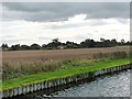
Dark clouds over Town End House, Stainforth
On the south bank of the Stainforth & Keadby Canal.
Image: © Christine Johnstone
Taken: 30 Sep 2016
0.02 miles
2
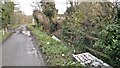
This, believe it or not, is a tidier part of Stainforth
As we walked through Stainforth we took away a lasting impression. There was litter, debris, fly tipping, anywhere. At the bottom of gardens, in ditches, on grass verges, chucked into fields. Fridges, doors, car parts, bottles, cans, boxes, tyres, you name it and it would be somewhere. This picture doesn't show the worst, possibly because it's truly everywhere.
No doubt there are other places like it, but we named Stainforth the litter capital of South Yorkshire. Hopefully they will soon have plans for a local week/month of action to clear it all up.
Image: © Chris Morgan
Taken: 15 Dec 2014
0.04 miles
3
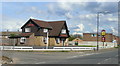
The Harvester, Stainforth
A modern pub in this mining village.
Image: © Jonathan Billinger
Taken: 1 May 2008
0.05 miles
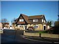
5
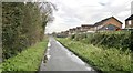
Gardens extended over drainage ditch at Stainforth
Interesting to see how some householders have bridged the drainage ditch to extend their gardens.
Image: © Chris Morgan
Taken: 15 Dec 2014
0.13 miles
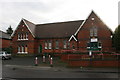
7
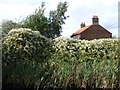
Russian vine, north bank, Stainforth & Keadby Canal
The house it hides is near the site of a lock into the River Don [now disappeared]. The associated basin is home to the Thorne Cruising Club.
Image: © Christine Johnstone
Taken: 30 Sep 2016
0.20 miles
8
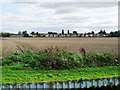
Stubble field, north-east of Stainforth
On the south bank of the Stainforth & Keadby Canal.
Image: © Christine Johnstone
Taken: 30 Sep 2016
0.21 miles
9
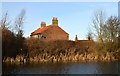
Stainforth & Keadby Canal No.3
This red brick house and its outbuildings adjacent to Thorne Marina in Stainforth are quite possibly the original basin keepers housing.
Image: © Bobby Clegg
Taken: 14 Jan 2015
0.22 miles
10
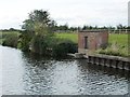
Drainage, north bank, Stainforth & Keadby Canal
The River Don is immediately behind the fenced embankment.
Image: © Christine Johnstone
Taken: 30 Sep 2016
0.22 miles