
IMAGES TAKEN NEAR TO
Thorne Road, DONCASTER, DN7 5BB
Introduction
This page details the photographs taken nearby to Thorne Road, DN7 5BB by members of the Geograph project.
The Geograph project started in 2005 with the aim of publishing, organising and preserving representative images for every square kilometre of Great Britain, Ireland and the Isle of Man.

There are currently over 7.5m images from over14,400 individuals and you can help contribute to the project by visiting https://www.geograph.org.uk
Image Map
Images are licensed for reuse under creativecommons.org/licenses/by-sa/2.0
Notes
- Clicking on the map will re-center to the selected point.
- The higher the marker number, the further away the image location is from the centre of the postcode.
Image Listing (43 Images Found)
Images are licensed for reuse under creativecommons.org/licenses/by-sa/2.0
Image
Details
Distance
2
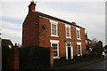
Field House
A detached house on Field Road
Image: © Graham Hogg
Taken: 15 Dec 2014
0.06 miles
3
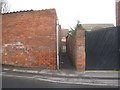
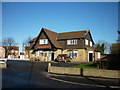
Very short path
Links Field Road to Silver Street.
Image: © Jonathan Thacker
Taken: 27 Jan 2012
0.07 miles
6
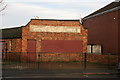
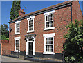
Ghost sign on Field Road
Former premises of a General Printer, though the name is now unreadable - R.G.ELLIN?
Image: © Graham Hogg
Taken: 15 Dec 2014
0.15 miles
7
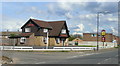
The Harvester, Stainforth
A modern pub in this mining village.
Image: © Jonathan Billinger
Taken: 1 May 2008
0.15 miles
8

Stainforth - Ethel at The New Inn
The community barge Ethel moored at The New Inn. This barge will have travelled along the Stainforth & Keadby Canal from the marina at Thorne and disembarked its passengers at The New Inn for lunch. For more details of the Ethel Community Barge Project, please see http://www.etheltrustcommunitybarge.co.uk/?q=content/typical-day-out-ethel . For an alternative view of The New Inn mooring, please see Image
Image: © Dave Bevis
Taken: 6 Jun 2014
0.17 miles
9
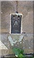
Ordnance Survey Flush Bracket (10212)
This OS Flush Bracket can be found on the NE angle of St Mary's Church. It marks a point 6.943m above mean sea level.
Image: © Adrian Dust
Taken: 24 May 2016
0.17 miles
10

Stainforth waterside from the west
Stainforth village fronting the canal, viewed from below the road bridge to the west.
Image: © George Robinson
Taken: 12 Aug 2007
0.17 miles