IMAGES TAKEN NEAR TO
Stanley Grove, DONCASTER, DN7 4EN
Introduction
This page details the photographs taken nearby to Stanley Grove, DN7 4EN by members of the Geograph project.
The Geograph project started in 2005 with the aim of publishing, organising and preserving representative images for every square kilometre of Great Britain, Ireland and the Isle of Man.

There are currently over 7.5m images from over14,400 individuals and you can help contribute to the project by visiting https://www.geograph.org.uk
Image Map
Images are licensed for reuse under creativecommons.org/licenses/by-sa/2.0
Notes
- Clicking on the map will re-center to the selected point.
- The higher the marker number, the further away the image location is from the centre of the postcode.
Image Listing (11 Images Found)
Images are licensed for reuse under creativecommons.org/licenses/by-sa/2.0
Image
Details
Distance
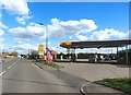
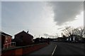
1
Semi-detached houses on Station Road, Dunscroft
Image: © Neil Theasby
Taken: 13 Jan 2022
0.02 miles
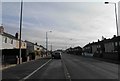
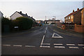
4
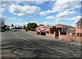
Station Road in Barnby Dun
Dunscroft Social Club can be seen to the right of the road in the centre of picture.
Image: © Jonathan Clitheroe
Taken: 31 Mar 2017
0.12 miles
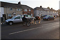
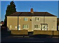
6
Houses on Station Road, Dunscroft
Caught in the late afternoon glare of a welcome sunny day in January.
Image: © Neil Theasby
Taken: 13 Jan 2022
0.16 miles
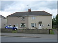
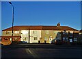
8
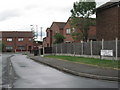
Orchard Grove
Residential area off Station Road.
Image: © Oxana Maher
Taken: 8 May 2007
0.18 miles