
IMAGES TAKEN NEAR TO
Dunsville, DONCASTER, DN7 4DA
Introduction
This page details the photographs taken nearby to DN7 4DA by members of the Geograph project.
The Geograph project started in 2005 with the aim of publishing, organising and preserving representative images for every square kilometre of Great Britain, Ireland and the Isle of Man.

There are currently over 7.5m images from over14,400 individuals and you can help contribute to the project by visiting https://www.geograph.org.uk
Image Map
Images are licensed for reuse under creativecommons.org/licenses/by-sa/2.0
Notes
- Clicking on the map will re-center to the selected point.
- The higher the marker number, the further away the image location is from the centre of the postcode.
Image Listing (11 Images Found)
Images are licensed for reuse under creativecommons.org/licenses/by-sa/2.0
Image
Details
Distance
1
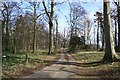
Drive to Wyndthorpe Hall
Wyndthorpe Hall, Dunsville is now a nursing home - this drive leads from the A18
Image: © Richard Croft
Taken: 20 Mar 2007
0.03 miles
3
Old milestone
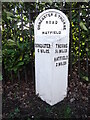
This West Riding CC milestone is on the A18 at the west end of Dunsville close to Wyndthorpe Hall entrance. It was stripped of old flaking paint and repainted in 2016 by a local resident. Because none of the place names are more than 10 letters long, the legends were cast horizontally. It is Grade II listed 1314827.
Image: © Chris Minto
Taken: 17 Mar 2019
0.06 miles
4
Old milestone
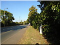
Although painted in 2016 the paint on this West Riding CC milestone is still in good condition. However there is a small patch near the base where the grass mower has chipped paint off. Also the hedge behind the railings which surround Wyndthorpe Hall is also encroaching onto the milestone.
Grade II listed 1314827.
Image: © Chris Minto
Taken: 31 Aug 2024
0.06 miles
5
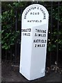
Old Milestone by the A18, High Street, Dunsville
Metal plate attached to stone post by the A18, in parish of HATFIELD (DONCASTER District), High Street, West end of Dunsville, close to entrance of Wyndthorpe Hall, on South side of road. Brayshaw & Booth iron casting, erected by the County Council in the 19th century.
Inscription reads:-
: DONCASTER / 5 MILES : : DONCASTER & THORNE / ROAD / HATFIELD : : THORNE / 5¼ MILES / HATFIELD / 2 MILES :
Maker:-
: BRAYSHAW & BOOTH / MAKERS / LIVERSEDGE :
Hole in top.
Grade II listed. List Entry Number: 1314827
https://historicengland.org.uk/listing/the-list/list-entry/1314827
Milestone Society National ID: YS_DNTH05.
Image: © C Minto
Taken: 1 Jan 1993
0.06 miles
7
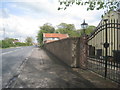
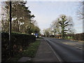
The A18 near Wyndthorpe Hall
The wall presumably formed part of the boundary of Wyndthorpe Hall.
Image: © Jonathan Thacker
Taken: 26 Apr 2014
0.08 miles
8
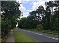
A18 Road near Wyndthorpe Hall
The hall (which is now a care home) is situated beyond the mature trees to the right.
Image: © Jonathan Clitheroe
Taken: 22 Jul 2017
0.09 miles
9
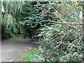
Spot the public footpath sign
Park Lane Dunsville, the path goes to West Moor Lane.
Image: © Steve Fareham
Taken: 9 Sep 2012
0.13 miles
10
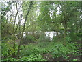
Pike Pool
Largely hidden by trees which are slowly turning it into a swamp rather than a pool.
Image: © Jonathan Thacker
Taken: 26 Apr 2014
0.15 miles