IMAGES TAKEN NEAR TO
Churchfield Road, DONCASTER, DN6 9LN
Introduction
This page details the photographs taken nearby to Churchfield Road, DN6 9LN by members of the Geograph project.
The Geograph project started in 2005 with the aim of publishing, organising and preserving representative images for every square kilometre of Great Britain, Ireland and the Isle of Man.

There are currently over 7.5m images from over14,400 individuals and you can help contribute to the project by visiting https://www.geograph.org.uk
Image Map
Images are licensed for reuse under creativecommons.org/licenses/by-sa/2.0
Notes
- Clicking on the map will re-center to the selected point.
- The higher the marker number, the further away the image location is from the centre of the postcode.
Image Listing (8 Images Found)
Images are licensed for reuse under creativecommons.org/licenses/by-sa/2.0
Image
Details
Distance
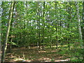
2

Ings Lane
Just a footpath between Campsall and Norton.
Image: © Jonathan Thacker
Taken: 30 Aug 2018
0.17 miles
3
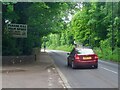
Church Field Road
At the vehicle entrance to Campsall Country Park
Image: © Graham Hogg
Taken: 23 May 2022
0.17 miles


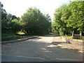
7
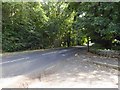
Leaving Campsall country park onto Church Field Road
Image: © Steve Fareham
Taken: 1 Sep 2015
0.19 miles