IMAGES TAKEN NEAR TO
Walden Stubbs Road, DONCASTER, DN6 9BF
Introduction
This page details the photographs taken nearby to Walden Stubbs Road, DN6 9BF by members of the Geograph project.
The Geograph project started in 2005 with the aim of publishing, organising and preserving representative images for every square kilometre of Great Britain, Ireland and the Isle of Man.

There are currently over 7.5m images from over14,400 individuals and you can help contribute to the project by visiting https://www.geograph.org.uk
Image Map
Images are licensed for reuse under creativecommons.org/licenses/by-sa/2.0
Notes
- Clicking on the map will re-center to the selected point.
- The higher the marker number, the further away the image location is from the centre of the postcode.
Image Listing (17 Images Found)
Images are licensed for reuse under creativecommons.org/licenses/by-sa/2.0
Image
Details
Distance
1
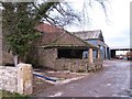
Norton Priory Farm
The most interesting of these buildings is the one nearest the camera, which appears to be a horse engine house attached to the barn. This would be where a horse walked in a circle to rotate an overhead wheel which would power a threshing machine in the adjoining barn.
Image: © Gordon Hatton
Taken: 9 Jan 2011
0.01 miles
2
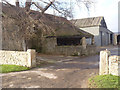
Probable gin house at Norton Priory
A gin was a horse-driven machine whereby the horse walked in a circle to drive other equipment.
Image: © Alan Murray-Rust
Taken: 27 Dec 2013
0.02 miles
3
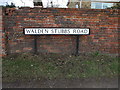
Walden Stubbs Road Sign
At the junction with Norton Mill Lane and Priory Lane in Norton Priory. The brick wall belongs to Priory Garth.
Image: © Matthew Hatton
Taken: 9 Jan 2011
0.07 miles
4
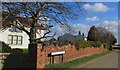
Walden Stubbs Road
Near Norton Priory.
Image: © steven ruffles
Taken: 1 Mar 2015
0.07 miles
5
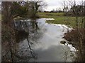
Mill Stream & Medieval Fish Ponds
Mill Stream from a rickety sleeper bridge at the back of Priory Farm, with the earthworks of medieval fishponds to the right.
Image: © Matthew Hatton
Taken: 9 Jan 2011
0.07 miles
6
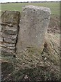
Gatepost with a Bench Mark
Benchmarked gatepost at Norton Priory, South Yorkshire. It is at a height of 13.00m according to the 1:2,500 map of 1991. Across the field is the village of Norton.
Roger Templeman asked me to link this to the Benchmarks database, so here it is:
http://www.bench-marks.org.uk/bm36734
Image: © Matthew Hatton
Taken: 9 Jan 2011
0.09 miles
7
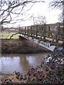
Footbridge over the Went
This footbridge over the River Went links a field with over friendly horses with another that is a complete mud bath.
Image: © Gordon Hatton
Taken: 9 Jan 2011
0.12 miles