
IMAGES TAKEN NEAR TO
Chestnut Avenue, DONCASTER, DN6 8BB
Introduction
This page details the photographs taken nearby to Chestnut Avenue, DN6 8BB by members of the Geograph project.
The Geograph project started in 2005 with the aim of publishing, organising and preserving representative images for every square kilometre of Great Britain, Ireland and the Isle of Man.

There are currently over 7.5m images from over14,400 individuals and you can help contribute to the project by visiting https://www.geograph.org.uk
Image Map
Images are licensed for reuse under creativecommons.org/licenses/by-sa/2.0
Notes
- Clicking on the map will re-center to the selected point.
- The higher the marker number, the further away the image location is from the centre of the postcode.
Image Listing (8 Images Found)
Images are licensed for reuse under creativecommons.org/licenses/by-sa/2.0
Image
Details
Distance
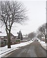
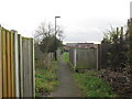
3
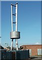
The Chimney
This unusual structure is the chimney for the heating system of Trafalgar House, a now derelict housing block owned by the council. It appears that this will all be demolished very soon.
Image: © John Bayes
Taken: 27 Feb 2013
0.19 miles
4
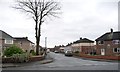
Edward Road, Skellow
Running north-east from Poplar Road.
Image: © Christine Johnstone
Taken: 20 Dec 2017
0.19 miles
6
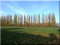
Sports Fields at Skellow
A rugby match is in progress behind the line of poplars.
Image: © Jonathan Clitheroe
Taken: 31 Oct 2015
0.23 miles
7
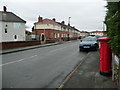
Elm Road, Skellow
Looking west from the junction with Poplar Road.
Image: © Christine Johnstone
Taken: 20 Dec 2017
0.24 miles
8
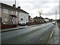
Bus stop on Poplar Road, Skellow
Just south of the junction with Lodge Road.
Image: © Christine Johnstone
Taken: 20 Dec 2017
0.24 miles