IMAGES TAKEN NEAR TO
Chestnut Avenue, DONCASTER, DN6 8AG
Introduction
This page details the photographs taken nearby to Chestnut Avenue, DN6 8AG by members of the Geograph project.
The Geograph project started in 2005 with the aim of publishing, organising and preserving representative images for every square kilometre of Great Britain, Ireland and the Isle of Man.

There are currently over 7.5m images from over14,400 individuals and you can help contribute to the project by visiting https://www.geograph.org.uk
Image Map
Images are licensed for reuse under creativecommons.org/licenses/by-sa/2.0
Notes
- Clicking on the map will re-center to the selected point.
- The higher the marker number, the further away the image location is from the centre of the postcode.
Image Listing (19 Images Found)
Images are licensed for reuse under creativecommons.org/licenses/by-sa/2.0
Image
Details
Distance
1
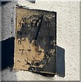
18thC Sundial
18thC Sundial
On the southern corner of one of the oldest houses in Carcroft.
Image: © John Bayes
Taken: 8 Apr 2018
0.01 miles
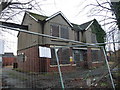
3
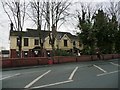
69 - 71 Skellow Road, Skellow
Two semi-detached houses adapted to create 9 one bedroom flats / bedsits, which have been vacant since November 2016. Together with the empty property at 73 Skellow Road, they were sold at auction in January 2017 for £240,000. They are still empty.
Image: © Christine Johnstone
Taken: 20 Dec 2017
0.07 miles
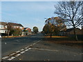
4
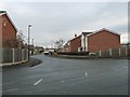
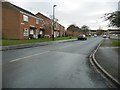
Dalecroft Road, Skellow
On the north side of Skellow Road [B1220].
Image: © Christine Johnstone
Taken: 20 Dec 2017
0.08 miles
5
73 Skellow Road, Skellow
This property contains 5 one bedroom flats / bedsits, but has been vacant since December 2010. Together with the two empty properties at 69 -71 Skellow Road, it was sold at auction in January 2017 for £240,000. It is still empty.
Image: © Christine Johnstone
Taken: 20 Dec 2017
0.09 miles
7
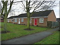
Bungalows on Skellow Road
On the south side of the B1220.
Image: © Christine Johnstone
Taken: 20 Dec 2017
0.10 miles
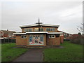
8
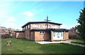
Carcroft, St George & The English Martyrs Roman Catholic Church
Image: © Bill Henderson
Taken: Unknown
0.12 miles
9

Bullcroft memorial
The wheel marks the site of the Bullcroft coal mine in the village of Carcroft, North of Doncaster. The mine closed in the 1970's.
Image: © John Bayes
Taken: Unknown
0.12 miles
10
Houses on the east side of Rolleston Road, Skellow
Looking south from the B1220.
Image: © Christine Johnstone
Taken: 20 Dec 2017
0.12 miles