
IMAGES TAKEN NEAR TO
Malvern Avenue, DONCASTER, DN5 8HJ
Introduction
This page details the photographs taken nearby to Malvern Avenue, DN5 8HJ by members of the Geograph project.
The Geograph project started in 2005 with the aim of publishing, organising and preserving representative images for every square kilometre of Great Britain, Ireland and the Isle of Man.

There are currently over 7.5m images from over14,400 individuals and you can help contribute to the project by visiting https://www.geograph.org.uk
Image Map
Images are licensed for reuse under creativecommons.org/licenses/by-sa/2.0
Notes
- Clicking on the map will re-center to the selected point.
- The higher the marker number, the further away the image location is from the centre of the postcode.
Image Listing (15 Images Found)
Images are licensed for reuse under creativecommons.org/licenses/by-sa/2.0
Image
Details
Distance
1

Sports Ground
Extensive playing fields on Doncaster's Anchorage Lane.
Image: © Mary and Angus Hogg
Taken: 13 Jun 2025
0.14 miles
2
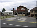
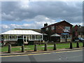
The Mallard
Despite recent events in Germany the England flags are still flying at the Mallard.
Image: © Michael Patterson
Taken: 7 Jul 2006
0.14 miles
4

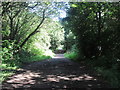
Heading for the Trans Pennine trail.
Dirty day.
Image: © steven ruffles
Taken: 6 Feb 2010
0.19 miles
7
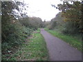
National Cycle Route 62 and Trans Pennine Trail
The former Hull and Barnsley and Great Central Joint line from Braithwell Junction to Bullcroft Junction. This section opened in 1916 and closed in 1979. No regular passenger services were ever run and its main purpose was to carry coal traffic from the pits of South Yorkshire to the docks at Hull.
Image: © Jonathan Thacker
Taken: 30 Oct 2012
0.21 miles
8
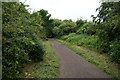
Trans Pennine Trail towards Richmond Hill, Doncaster
Image: © Ian S
Taken: 31 May 2014
0.21 miles
9

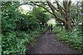
Which gate shall I take?
Entrance onto Trans Pennine Trail.
Image: © Steve Fareham
Taken: 26 Aug 2007
0.22 miles
10
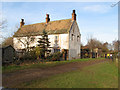
Keeper's Cottage
An isolated house at the end of Orchard Lane. From the name it must be assumed that it was associated with the nearby Cusworth Hall.
Image: © Jonathan Wilkins
Taken: 24 Feb 2011
0.22 miles