IMAGES TAKEN NEAR TO
Crompton Avenue, DONCASTER, DN5 8EE
Introduction
This page details the photographs taken nearby to Crompton Avenue, DN5 8EE by members of the Geograph project.
The Geograph project started in 2005 with the aim of publishing, organising and preserving representative images for every square kilometre of Great Britain, Ireland and the Isle of Man.

There are currently over 7.5m images from over14,400 individuals and you can help contribute to the project by visiting https://www.geograph.org.uk
Image Map
Images are licensed for reuse under creativecommons.org/licenses/by-sa/2.0
Notes
- Clicking on the map will re-center to the selected point.
- The higher the marker number, the further away the image location is from the centre of the postcode.
Image Listing (12 Images Found)
Images are licensed for reuse under creativecommons.org/licenses/by-sa/2.0
Image
Details
Distance
1

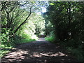
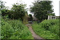
Which gate shall I take?
Entrance onto Trans Pennine Trail.
Image: © Steve Fareham
Taken: 26 Aug 2007
0.10 miles
2

Heading for the Trans Pennine trail.
Dirty day.
Image: © steven ruffles
Taken: 6 Feb 2010
0.11 miles
4
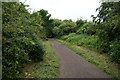
Trans Pennine Trail towards Richmond Hill, Doncaster
Image: © Ian S
Taken: 31 May 2014
0.16 miles
5

Sports Ground
Extensive playing fields on Doncaster's Anchorage Lane.
Image: © Mary and Angus Hogg
Taken: 13 Jun 2025
0.17 miles

8

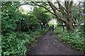
Ivanhoe Close
Residential area on the west side of Doncaster.
Image: © Mary and Angus Hogg
Taken: 13 Jun 2025
0.19 miles
9

Path near Shelley Grove
The path forms part of National Cycle Network route 62 with this section running along the course of the former Gowdall and Braithwell line.
Image: © DS Pugh
Taken: 13 Apr 2025
0.19 miles