
IMAGES TAKEN NEAR TO
Sprotbrough Road, DONCASTER, DN5 8BB
Introduction
This page details the photographs taken nearby to Sprotbrough Road, DN5 8BB by members of the Geograph project.
The Geograph project started in 2005 with the aim of publishing, organising and preserving representative images for every square kilometre of Great Britain, Ireland and the Isle of Man.

There are currently over 7.5m images from over14,400 individuals and you can help contribute to the project by visiting https://www.geograph.org.uk
Image Map
Images are licensed for reuse under creativecommons.org/licenses/by-sa/2.0
Notes
- Clicking on the map will re-center to the selected point.
- The higher the marker number, the further away the image location is from the centre of the postcode.
Image Listing (8 Images Found)
Images are licensed for reuse under creativecommons.org/licenses/by-sa/2.0
Image
Details
Distance
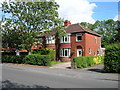
2
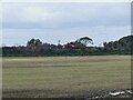
Freight train on the Doncaster Avoiding Line
The line, 3 miles 22 chains long from Hexthorpe to Bentley, was built by the Great Central Railway in 1908-10 in preparation for the opening of Immingham Dock in 1912, and its purpose was to take slower freight trains to/from Humberside over the LNER's East Coast main line rather than go through Doncaster station. It still fulfils that purpose (though traffic is lighter since the demise of the coal industry), and has never been used for regular passenger services. Source: https://en-academic.com/dic.nsf/enwiki/11656853
Image: © Stephen Craven
Taken: 23 Sep 2023
0.11 miles

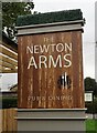
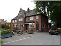
7
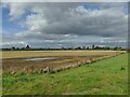
Newton Ings
A large, flat, arable field of about 20 hectares adjacent to the river Don. There is a floodbank, but the name suggests that it was historically subject to flooding, and with more extreme weather resulting from climate change, may be at risk again.
Image: © Stephen Craven
Taken: 23 Sep 2023
0.21 miles
8

Footpath through a broccoli field
The line of this footpath close to the River Don appears to have been marked using weedkiller.
Image: © Graham Hogg
Taken: 11 Nov 2011
0.23 miles