IMAGES TAKEN NEAR TO
Scawsby Lane, DONCASTER, DN5 7UG
Introduction
This page details the photographs taken nearby to Scawsby Lane, DN5 7UG by members of the Geograph project.
The Geograph project started in 2005 with the aim of publishing, organising and preserving representative images for every square kilometre of Great Britain, Ireland and the Isle of Man.

There are currently over 7.5m images from over14,400 individuals and you can help contribute to the project by visiting https://www.geograph.org.uk
Image Map
Images are licensed for reuse under creativecommons.org/licenses/by-sa/2.0
Notes
- Clicking on the map will re-center to the selected point.
- The higher the marker number, the further away the image location is from the centre of the postcode.
Image Listing (19 Images Found)
Images are licensed for reuse under creativecommons.org/licenses/by-sa/2.0
Image
Details
Distance
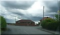
1
Scawsby Lane, junction with the B6422
Image: © Bill Henderson
Taken: 21 Nov 2006
0.04 miles
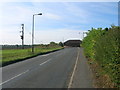
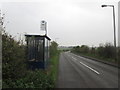
5
![40 mph on Green Lane [B6422]](https://s3.geograph.org.uk/geophotos/06/05/21/6052187_4c8655f9_120x120.jpg)
40 mph on Green Lane [B6422]
Looking west from Roman Ridge.
Image: © Christine Johnstone
Taken: 2 Feb 2019
0.08 miles
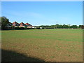
8
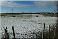
Paddocks off Green Lane
Looking west from Roman Ridge
Image: © Christine Johnstone
Taken: 2 Feb 2019
0.11 miles