IMAGES TAKEN NEAR TO
Thorpe Lane, DONCASTER, DN5 7QD
Introduction
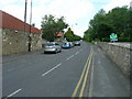
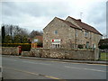
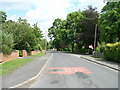
This page details the photographs taken nearby to Thorpe Lane, DN5 7QD by members of the Geograph project.
The Geograph project started in 2005 with the aim of publishing, organising and preserving representative images for every square kilometre of Great Britain, Ireland and the Isle of Man.

There are currently over 7.5m images from over14,400 individuals and you can help contribute to the project by visiting https://www.geograph.org.uk
Image Map
Images are licensed for reuse under creativecommons.org/licenses/by-sa/2.0
Notes
- Clicking on the map will re-center to the selected point.
- The higher the marker number, the further away the image location is from the centre of the postcode.
Image Listing (30 Images Found)
Images are licensed for reuse under creativecommons.org/licenses/by-sa/2.0
Image
Details
Distance
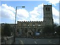
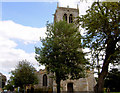
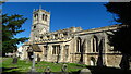
6
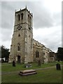
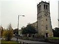
Church of St Mary the Virgin, Sprotborough
Image: © Neil Theasby
Taken: 27 Jul 2015
0.06 miles
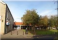
10
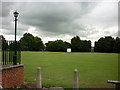
The cricket pitch behind the Ivanhoe Hotel
A Sam Smith's pub in Sprotbrough near Doncaster.
Image: © Ian S
Taken: 4 Aug 2010
0.07 miles