IMAGES TAKEN NEAR TO
Roe Croft Close, DONCASTER, DN5 7QB
Introduction
This page details the photographs taken nearby to Roe Croft Close, DN5 7QB by members of the Geograph project.
The Geograph project started in 2005 with the aim of publishing, organising and preserving representative images for every square kilometre of Great Britain, Ireland and the Isle of Man.

There are currently over 7.5m images from over14,400 individuals and you can help contribute to the project by visiting https://www.geograph.org.uk
Image Map
Images are licensed for reuse under creativecommons.org/licenses/by-sa/2.0
Notes
- Clicking on the map will re-center to the selected point.
- The higher the marker number, the further away the image location is from the centre of the postcode.
Image Listing (10 Images Found)
Images are licensed for reuse under creativecommons.org/licenses/by-sa/2.0
Image
Details
Distance
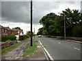
5
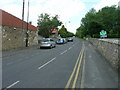
Looking along the line of Melton Road, Sprotbrough
looking eastwards towards Doncaster
Image: © Nigel Homer
Taken: 25 Feb 2006
0.14 miles
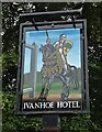
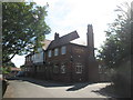
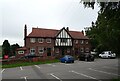
6
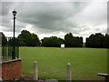
The cricket pitch behind the Ivanhoe Hotel
A Sam Smith's pub in Sprotbrough near Doncaster.
Image: © Ian S
Taken: 4 Aug 2010
0.15 miles
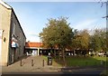
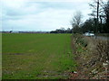
7
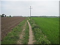
Field Footpath from Sprotbrough
Turn right at the end to go to Cusworth Country Park.
Image: © Martin Dawes
Taken: 29 Apr 2010
0.16 miles