IMAGES TAKEN NEAR TO
The Green, DONCASTER, DN5 7DD
Introduction
This page details the photographs taken nearby to The Green, DN5 7DD by members of the Geograph project.
The Geograph project started in 2005 with the aim of publishing, organising and preserving representative images for every square kilometre of Great Britain, Ireland and the Isle of Man.

There are currently over 7.5m images from over14,400 individuals and you can help contribute to the project by visiting https://www.geograph.org.uk
Image Map
Images are licensed for reuse under creativecommons.org/licenses/by-sa/2.0
Notes
- Clicking on the map will re-center to the selected point.
- The higher the marker number, the further away the image location is from the centre of the postcode.
Image Listing (40 Images Found)
Images are licensed for reuse under creativecommons.org/licenses/by-sa/2.0
Image
Details
Distance
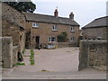
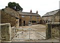
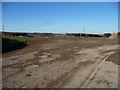
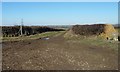
2
Common Lane, Clayton
Looking northwards.
Image: © Christine Johnstone
Taken: 9 Feb 2015
0.06 miles
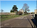
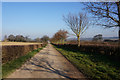
4
Footpath at 5 ways Clayton
Footpaths, bridleways and lanes all intersect here The Green near Clayton.
Image: © Steve Fareham
Taken: 28 Oct 2007
0.07 miles
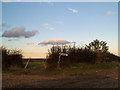
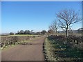
5
Five ways, Common Lane, Clayton
With an 81 metre spot height in the centre of the junction.
Image: © Christine Johnstone
Taken: 9 Feb 2015
0.08 miles
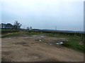
7
Track running east from Common Lane, Clayton
A private track but a public footpath. Heading to Frickley.
Image: © Christine Johnstone
Taken: 9 Feb 2015
0.09 miles
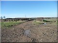
8
5-Way Track Junction on Clayton Common
Just north of the village is this congregation point where five path cum tracks converge.
Image: © Jonathan Clitheroe
Taken: 10 Mar 2017
0.10 miles
9
Public footpath to West Farm, South Kirkby
Heading north from its junction with Clayton's Common Lane, at an 81 metre spot height.
Image: © Christine Johnstone
Taken: 9 Feb 2015
0.11 miles
10
Common Lane, Clayton Common
Heading north-west from a five ways junction, towards Spring Wood.
Image: © Christine Johnstone
Taken: 9 Feb 2015
0.12 miles