
IMAGES TAKEN NEAR TO
Ainthorpe Road, DONCASTER, DN5 0RD
Introduction
This page details the photographs taken nearby to Ainthorpe Road, DN5 0RD by members of the Geograph project.
The Geograph project started in 2005 with the aim of publishing, organising and preserving representative images for every square kilometre of Great Britain, Ireland and the Isle of Man.

There are currently over 7.5m images from over14,400 individuals and you can help contribute to the project by visiting https://www.geograph.org.uk
Image Map
Images are licensed for reuse under creativecommons.org/licenses/by-sa/2.0
Notes
- Clicking on the map will re-center to the selected point.
- The higher the marker number, the further away the image location is from the centre of the postcode.
Image Listing (12 Images Found)
Images are licensed for reuse under creativecommons.org/licenses/by-sa/2.0
Image
Details
Distance
1
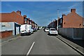
Marton Road - off Adwick Lane, Toll Bar
Image: © Neil Theasby
Taken: 21 Apr 2022
0.04 miles
2
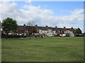
Terrace at Toll Bar
Slightly separated from the main part of the settlement.
Image: © Jonathan Thacker
Taken: 31 May 2015
0.04 miles
3
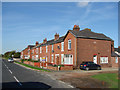
Last houses leaving Toll Bar on Adwick Lane, towards Adwick le Street.
Image: © Bill Henderson
Taken: 29 Oct 2006
0.05 miles
4
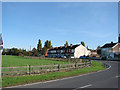
Entering Toll Bar on Adwick lane, from Adwick le Street.
Image: © Bill Henderson
Taken: 29 Oct 2006
0.06 miles
5
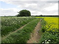
Track and oilseed rape at Toll Bar
Image: © Jonathan Thacker
Taken: 31 May 2015
0.06 miles

7

A19 Askern Road in Toll Bar
Heading north out of the village.
Image: © Jonathan Clitheroe
Taken: 19 Dec 2015
0.17 miles
8
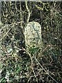
Old milestone
Often hidden in the ditch in summer this stone on the A19 just north of Tollbar was set up for the Doncaster - Selby turnpike of 1832, one of the last to be enacted in Yorkshire. All the remaining stones on this route have, except this one and DNSY08 at SE 5651 1613, recessed panels at each side. It is Grade II listed.
Image: © Chris Minto
Taken: 28 Feb 2021
0.20 miles
9
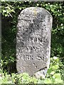
Old Milestone by the A19, Doncaster Road, Toll Bar, Bentley parish
Carved stone post by the A19, in parish of Bentley (Doncaster District), Doncaster Road, Toll Bar, 130m North of junction with Adwick Lane, just North of village and UC road to West, in ditch 15m South of road sign, on East side of road. Erected by the Doncaster & Selby (new Trust) turnpike trust in the 19th century.
Inscription reads:-
DONCASTER
3½ MILES
ASKERN 3½
SELBY (16½)
YORK 31
Grade II listed.
List Entry Number: 1151491 https://historicengland.org.uk/listing/the-list/list-entry/1151491
Milestone Society National ID: YS_DNSY03
Image: © C Minto
Taken: 1 Nov 2001
0.20 miles
