
IMAGES TAKEN NEAR TO
Church Rein Close, DONCASTER, DN4 9PG
Introduction
This page details the photographs taken nearby to Church Rein Close, DN4 9PG by members of the Geograph project.
The Geograph project started in 2005 with the aim of publishing, organising and preserving representative images for every square kilometre of Great Britain, Ireland and the Isle of Man.

There are currently over 7.5m images from over14,400 individuals and you can help contribute to the project by visiting https://www.geograph.org.uk
Image Map
Images are licensed for reuse under creativecommons.org/licenses/by-sa/2.0
Notes
- Clicking on the map will re-center to the selected point.
- The higher the marker number, the further away the image location is from the centre of the postcode.
Image Listing (19 Images Found)
Images are licensed for reuse under creativecommons.org/licenses/by-sa/2.0
Image
Details
Distance
2

Bus stop on Tenter Lane
The Tenter Lane / Mill Lane bus stop in the Warmsworth area of Doncaster.
Image: © DS Pugh
Taken: 13 Apr 2025
0.15 miles
3
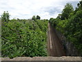
Sprotborough (SYR) railway station (site), Yorkshire
Opened in 1850 by the South Yorkshire Railway, later part of the Manchester Sheffield & Lincolnshire Railway, on the line from Mexborough to Doncaster, this station closed in 1875.
View east towards Doncaster. This is a very improbable location for a station, being in a deep and narrow cutting. The 1892 OS map refers to the bridge here as "Station Bridge" and the 1852 map shows 2 slightly staggered platforms in the cutting to the east of the bridge, although no station is named.
One of Yorkshire's more esoteric railway station sites...
Image: © Nigel Thompson
Taken: 11 Jul 2020
0.16 miles
4
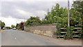
Railway bridge abutment in Warmsworth.
Image: © Steve Fareham
Taken: 16 Sep 2007
0.17 miles
5

George VI Type E Wall Box
Mounted on the garden wall of a house on the corner of Tenter Road.
Image: © Siobhan Brennan-Raymond
Taken: 10 Feb 2013
0.18 miles
6

Mill Lane in Warmsworth
Approaching the junction with Tenter Lane.
Image: © DS Pugh
Taken: 13 Apr 2025
0.19 miles

10
Warmsworth : A1(M)
Looking along the A1(M) heading northbound.
Image: © Lewis Clarke
Taken: 21 Sep 2020
0.21 miles