
IMAGES TAKEN NEAR TO
Magenta Crescent, DONCASTER, DN4 8EA
Introduction
This page details the photographs taken nearby to Magenta Crescent, DN4 8EA by members of the Geograph project.
The Geograph project started in 2005 with the aim of publishing, organising and preserving representative images for every square kilometre of Great Britain, Ireland and the Isle of Man.

There are currently over 7.5m images from over14,400 individuals and you can help contribute to the project by visiting https://www.geograph.org.uk
Image Map
Images are licensed for reuse under creativecommons.org/licenses/by-sa/2.0
Notes
- Clicking on the map will re-center to the selected point.
- The higher the marker number, the further away the image location is from the centre of the postcode.
Image Listing (7 Images Found)
Images are licensed for reuse under creativecommons.org/licenses/by-sa/2.0
Image
Details
Distance
1
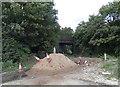
On Hall Balk Lane
A pile of sand with an old railway bridge beyond - belonging to a dismantled railway track
Image: © Neil Theasby
Taken: 9 Aug 2014
0.07 miles
2
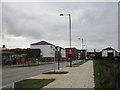
New housing, Woodfield Way
A rapidly expanding area.
Image: © Jonathan Thacker
Taken: 10 Oct 2015
0.13 miles
3
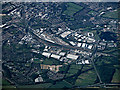
Doncaster from the air
The M18 motorway is in the foreground as is the Tesco Extra superstore. The railway works dominate the scene, with the Keepmoat Stadium home of Doncaster Rovers FC and Duncaster Rugby League FC to the right, beside Lakeside Lake.
Image: © Thomas Nugent
Taken: 6 Jul 2020
0.14 miles
4

Path and Former Railway near Littlewood's Plantation
Pictured from the western edge of the square.
Image: © Jonathan Clitheroe
Taken: 2 Nov 2016
0.15 miles
5
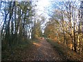
Path and Former Mineral Line
Recreational path following the line of a railway which served Yorkshire Main Colliery. The track now forms a kind of informal boundary between urban encroachment from the north and undeveloped farmland to the south. Houses on the edge of the new Woodfield development can be glimpsed through the trees to the left of the path.
Image: © Jonathan Clitheroe
Taken: 2 Nov 2016
0.16 miles
6
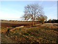
Drain and Field Boundary Viewed from Hall Balk Lane
Image: © Jonathan Clitheroe
Taken: 2 Nov 2016
0.17 miles
7
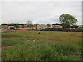
New housing, Woodfield Plantation
A rapidly expanding area.
Image: © Jonathan Thacker
Taken: 10 Oct 2015
0.24 miles