Doncaster from the air
Introduction
The photograph on this page of Doncaster from the air by Thomas Nugent as part of the Geograph project.
The Geograph project started in 2005 with the aim of publishing, organising and preserving representative images for every square kilometre of Great Britain, Ireland and the Isle of Man.

There are currently over 7.5m images from over 14,400 individuals and you can help contribute to the project by visiting https://www.geograph.org.uk
Doncaster from the air
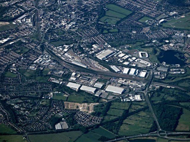
Image: © Thomas Nugent Taken: 6 Jul 2020
The M18 motorway is in the foreground as is the Tesco Extra superstore. The railway works dominate the scene, with the Keepmoat Stadium home of Doncaster Rovers FC and Duncaster Rugby League FC to the right, beside Lakeside Lake.
Images are licensed for reuse under creativecommons.org/licenses/by-sa/2.0
Image Location
Latitude
53.490407
Longitude
-1.132122