
IMAGES TAKEN NEAR TO
Lakeside Boulevard, DN4 5QD
Introduction
This page details the photographs taken nearby to Lakeside Boulevard, DN4 5QD by members of the Geograph project.
The Geograph project started in 2005 with the aim of publishing, organising and preserving representative images for every square kilometre of Great Britain, Ireland and the Isle of Man.

There are currently over 7.5m images from over14,400 individuals and you can help contribute to the project by visiting https://www.geograph.org.uk
Image Map
Images are licensed for reuse under creativecommons.org/licenses/by-sa/2.0
Notes
- Clicking on the map will re-center to the selected point.
- The higher the marker number, the further away the image location is from the centre of the postcode.
Image Listing (54 Images Found)
Images are licensed for reuse under creativecommons.org/licenses/by-sa/2.0
Image
Details
Distance
1
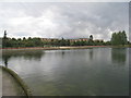
The Lake, Doncaster Lakeside (3)
Showing some of the housing development close to this artificial lake.
Image: © Jonathan Thacker
Taken: 26 Sep 2012
0.03 miles
2
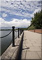
Doncaster Lakeside walkway
Paved waterside path close to Lakeside Boulevard
Image: © Paul Harrop
Taken: 2 Aug 2013
0.06 miles
3
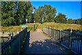
Doncaster : Footbridge
A footbridge heads across towards and island in the lake.
Image: © Lewis Clarke
Taken: 21 Sep 2020
0.06 miles
4
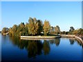
Doncaster Lakeside and Island
The wooden footbridge on the right gives access to the island area in the centre of picture.
Image: © Jonathan Clitheroe
Taken: 25 Oct 2016
0.07 miles
5
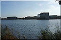
View across the Lake, Lakeside, Doncaster
Image: © Bill Henderson
Taken: 29 Oct 2008
0.09 miles
6
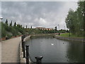
Doncaster Lakeside
Part of an artificial lake created as the focus of a mixed residential, commercial and recreational development.
Image: © Jonathan Thacker
Taken: 26 Sep 2012
0.09 miles
7

Doncaster : Lakeside Lake
A footpath heads around the lake.
Image: © Lewis Clarke
Taken: 21 Sep 2020
0.09 miles
8
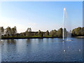
Lakeside
Doncaster Lakeside is a man-made lake built on the site of a former airfield and rubbish dump. It was created as part of the leisure and business development of the surrounding area in the late 1990s. The 50-acre lake was a critical component of the design concept for the Lakeside project which was completed in 2002. The lake not only provided an amenity but was also used as a resource to provide fill material to bring marshy land to the south to above flood level. (http://www.som.com/content.cfm/doncaster_lakeside Skidmore, Owings & Merrill Architects)
Prior to this, the site was occupied by fields with straight and regular edges indicative of parliamentary enclosure. It was part of High Ellers Common prior to enclosure in 1779 by the 'Cantley, Branton, Bessacarr and (High) Ellers' award. (http://sytimescapes.org.uk/node/6321 South Yorkshire Historic Environment Characterisation)
Image: © David Dixon
Taken: 14 Oct 2011
0.09 miles
9
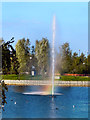
The Fountain at Lakeside
Diffraction of the sunlight by the tiny water droplets has caused a rainbow effect in the spray from the fountain.
Doncaster Lakeside is a man-made lake built on the site of a former airfield and rubbish dump. It was created as part of the leisure and business development of the surrounding area in the late 1990s. The 50-acre lake was a critical component of the design concept for the Lakeside project which was completed in 2002. The lake not only provided an amenity but was also used as a resource to provide fill material to bring marshy land to the south to above flood level. (http://www.som.com/content.cfm/doncaster_lakeside Skidmore, Owings & Merrill Architects)
Prior to this, the site was occupied by fields with straight and regular edges indicative of parliamentary enclosure. It was part of High Ellers Common prior to enclosure in 1779 by the 'Cantley, Branton, Bessacarr and (High) Ellers' award. (http://sytimescapes.org.uk/node/6321 South Yorkshire Historic Environment Characterisation)
Image: © David Dixon
Taken: 14 Oct 2011
0.10 miles
10
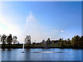
Fountain, Doncaster Lakeside
Doncaster Lakeside is a man-made lake built on the site of a former airfield and rubbish dump. It was created as part of the leisure and business development of the surrounding area in the late 1990s. The 50-acre lake was a critical component of the design concept for the Lakeside project which was completed in 2002. The lake not only provided an amenity but was also used as a resource to provide fill material to bring marshy land to the south to above flood level. (http://www.som.com/content.cfm/doncaster_lakeside Skidmore, Owings & Merrill Architects)
Prior to this, the site was occupied by fields with straight and regular edges indicative of parliamentary enclosure. It was part of High Ellers Common prior to enclosure in 1779 by the 'Cantley, Branton, Bessacarr and (High) Ellers' award. (http://sytimescapes.org.uk/node/6321 South Yorkshire Historic Environment Characterisation)
Image: © David Dixon
Taken: 14 Oct 2011
0.10 miles