IMAGES TAKEN NEAR TO
Carr Lane, GRIMSBY, DN41 8BA
Introduction
This page details the photographs taken nearby to Carr Lane, DN41 8BA by members of the Geograph project.
The Geograph project started in 2005 with the aim of publishing, organising and preserving representative images for every square kilometre of Great Britain, Ireland and the Isle of Man.

There are currently over 7.5m images from over14,400 individuals and you can help contribute to the project by visiting https://www.geograph.org.uk
Image Map
Images are licensed for reuse under creativecommons.org/licenses/by-sa/2.0
Notes
- Clicking on the map will re-center to the selected point.
- The higher the marker number, the further away the image location is from the centre of the postcode.
Image Listing (18 Images Found)
Images are licensed for reuse under creativecommons.org/licenses/by-sa/2.0
Image
Details
Distance
1

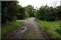
Footpath to Healing
At this point the footpath is along a farm track.
Image: © Jonathan Thacker
Taken: 27 Jul 2011
0.07 miles
4
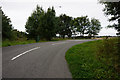
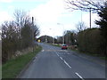
Carr Lane at South Marsh Road, Stallingborough
Image: © Ian S
Taken: 20 Sep 2017
0.11 miles
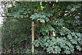
6
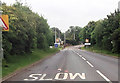
Station road entering Stallingborough from the north
Image: © John Firth
Taken: 16 Jun 2012
0.13 miles
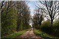
10

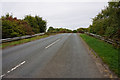
Former course of South Marsh Road
South Marsh Road was diverted slightly to the west and onto an overbridge when the A180 was constructed.
Image: © Jonathan Thacker
Taken: 27 Jul 2011
0.17 miles