IMAGES TAKEN NEAR TO
Hexthorpe Road, DONCASTER, DN4 0BG
Introduction
This page details the photographs taken nearby to Hexthorpe Road, DN4 0BG by members of the Geograph project.
The Geograph project started in 2005 with the aim of publishing, organising and preserving representative images for every square kilometre of Great Britain, Ireland and the Isle of Man.

There are currently over 7.5m images from over14,400 individuals and you can help contribute to the project by visiting https://www.geograph.org.uk
Image Map (Loading...)


Getting Data...Please wait
Leaflet Map data © OpenStreetMap
Images are licensed for reuse under creativecommons.org/licenses/by-sa/2.0
Notes
- Clicking on the map will re-center to the selected point.
- The higher the marker number, the further away the image location is from the centre of the postcode.
Image Listing (78 Images Found)
Images are licensed for reuse under creativecommons.org/licenses/by-sa/2.0
Image
Details
Distance
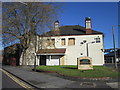
1
The Junction community centre, Hexthorpe Road
Shown as an inn on the 1903 map, and (at least in later years) called the Rising Sun, since 2004 this has been a community centre established by the Methodist church. See https://thejunctionhexthorpe.com/our-story/
Image: © Stephen Craven
Taken: 16 Mar 2024
0.01 miles
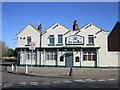
3
The Red Dragon, Hexthorpe Road
A Chinese and Thai takeaway on the corner of Abbott Street.
Image: © Stephen Craven
Taken: 16 Mar 2024
0.04 miles
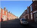
4
Hexthorpe Road looking west from Flowitt Street
There is a post office on the right hand side, and in the distance the fleche of St Jude's church Image
Image: © Stephen Craven
Taken: 16 Mar 2024
0.05 miles
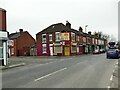
5
Kirk Street, Hexthorpe
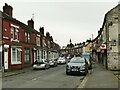
The street is on of a few in the area that have been pedestrianised to the extent of no motor vehicles being allowed 'except for loading'. According to the Doncaster Free Press, this part of Hexthorpe was being plagued by antisocial behaviour, and has been made the subject of a PSPO (Public Space Protection Order) with extensive CCTV coverage. Maybe it has worked, or maybe Saturday afternoon is a quiet time anyway, but I saw no problems as I passed through.
Image: © Stephen Craven
Taken: 16 Mar 2024
0.08 miles
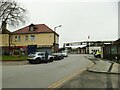
6
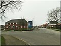
Pullman Green, Hexthorpe (1)
The entrance from Flowitt Street into a large housing estate, the far end of which is still under construction, on the site of the westernmost part of Doncaster's once extensive railway engineering works Image What makes this estate unusual is that all the properties are being built for rental rather than owner-occupation.
Image: © Stephen Craven
Taken: 16 Mar 2024
0.08 miles
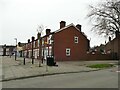
9
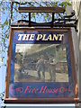
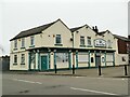
Entrance to Doncaster railway works off Hexthorpe Road
The building to the left, now housing a barbers and one other shop, is shown as a beer house on the 1902 map; until sometime shortly before 2012 it was still a pub called the Plant Image but has been significantly altered since then.
Image: © Stephen Craven
Taken: 16 Mar 2024
0.09 miles