
IMAGES TAKEN NEAR TO
Immingham Road, IMMINGHAM, DN40 3BD
Introduction
This page details the photographs taken nearby to Immingham Road, DN40 3BD by members of the Geograph project.
The Geograph project started in 2005 with the aim of publishing, organising and preserving representative images for every square kilometre of Great Britain, Ireland and the Isle of Man.

There are currently over 7.5m images from over14,400 individuals and you can help contribute to the project by visiting https://www.geograph.org.uk
Image Map
Images are licensed for reuse under creativecommons.org/licenses/by-sa/2.0
Notes
- Clicking on the map will re-center to the selected point.
- The higher the marker number, the further away the image location is from the centre of the postcode.
Image Listing (33 Images Found)
Images are licensed for reuse under creativecommons.org/licenses/by-sa/2.0
Image
Details
Distance

2
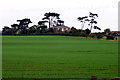
Church Farm
Picture taken from a lay-by on the A180(T) looking approx. NE.
Image: © David Wright
Taken: 19 Oct 2005
0.09 miles
3

Ridge and furrow NE of Habrough: aerial 2025 (1)
Image: © Chris
Taken: 30 Dec 2025
0.12 miles
4
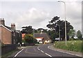
Bend approaching roundabout on Immingham Road
Image: © John Firth
Taken: 14 Jun 2013
0.13 miles
5
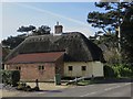
Thatched house, near Habrough
Next to the B1210 Immingham Road, thatched buildings being a relatively rare sight in this area.
Image: © Paul Harrop
Taken: 19 Feb 2017
0.14 miles
6
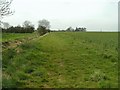
Looking back beside the stream
A view westwards towards Habrough.
Image: © John Beal
Taken: 22 Apr 2008
0.17 miles
7
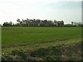
Across the field
The group of buildings that can be seen surround a "Y" junction of roads to the east of Habrough. The topmost part of the church steeple can be seen, together with the Habrough Hotel on the right. The view is from the footpath.
Image: © John Beal
Taken: 22 Apr 2008
0.17 miles
8
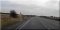
Lay-by 7 (from the M180) on the A180 heading East
Lay-bys occur every 1 mile.
Image: © Steve Fareham
Taken: 10 Nov 2012
0.17 miles
9

Habrough Church
Church of St. Margaret, Habrough. Pevsner says that this building dates from 1869. The tower has an octagonal bell stage and small spire.
Image: © David Wright
Taken: 15 Oct 2005
0.18 miles
10
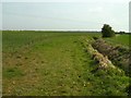
Footpath beside the stream
The continuation of the route to South Killingholme follows a rather twisty course through flat farmland.
Image: © John Beal
Taken: 22 Apr 2008
0.18 miles