IMAGES TAKEN NEAR TO
Winslow Drive, IMMINGHAM, DN40 2BQ
Introduction
This page details the photographs taken nearby to Winslow Drive, DN40 2BQ by members of the Geograph project.
The Geograph project started in 2005 with the aim of publishing, organising and preserving representative images for every square kilometre of Great Britain, Ireland and the Isle of Man.

There are currently over 7.5m images from over14,400 individuals and you can help contribute to the project by visiting https://www.geograph.org.uk
Image Map
Images are licensed for reuse under creativecommons.org/licenses/by-sa/2.0
Notes
- Clicking on the map will re-center to the selected point.
- The higher the marker number, the further away the image location is from the centre of the postcode.
Image Listing (27 Images Found)
Images are licensed for reuse under creativecommons.org/licenses/by-sa/2.0
Image
Details
Distance
2
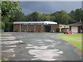
Church of Our Lady Star of the Sea
Roman Catholic Church.
Image: © Jonathan Thacker
Taken: 27 Aug 2011
0.07 miles
4
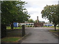
Allerton Primary School
Immingham greatly expanded in the 1960s and 1970s and most of its public buildings date from that time. Now they are beginning to show their age and lack of maintenance is taking its toll. Parts of this school are looking a bit shabby. But external appearances are not reflected by what goes on within the school buildings. This is rated a Good school by Ofsted.
Image: © Jonathan Thacker
Taken: 27 Aug 2011
0.11 miles
6
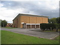
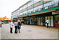
The rear of Immingham Sports Centre
Designed by Cleethorpes Borough Council Architect's Department in 1981: chief architect J.T. MacNaughton-Jones.
Image: © Jonathan Thacker
Taken: 27 Aug 2011
0.14 miles
7
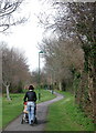
Green Lane, Immingham
On 1940s Ordnance Survey maps Immingham still has comparatively few houses, mostly along the sides of Church Lane, Bluestone Lane and Pelham Road, with Green Lane crossing the open fields in between. Since the expansion of the docks in around 1970 and the subsequent growth of industry on the Humber bank the area has become a mass of housing, yet somehow Green Lane has managed to stay relatively green.
Image: © Paul Glazzard
Taken: 13 Mar 2008
0.15 miles