IMAGES TAKEN NEAR TO
Cranwell Drive, GRIMSBY, DN37 9LU
Introduction
This page details the photographs taken nearby to Cranwell Drive, DN37 9LU by members of the Geograph project.
The Geograph project started in 2005 with the aim of publishing, organising and preserving representative images for every square kilometre of Great Britain, Ireland and the Isle of Man.

There are currently over 7.5m images from over14,400 individuals and you can help contribute to the project by visiting https://www.geograph.org.uk
Image Map
Images are licensed for reuse under creativecommons.org/licenses/by-sa/2.0
Notes
- Clicking on the map will re-center to the selected point.
- The higher the marker number, the further away the image location is from the centre of the postcode.
Image Listing (5 Images Found)
Images are licensed for reuse under creativecommons.org/licenses/by-sa/2.0
Image
Details
Distance
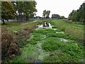
4
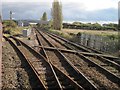
Marsh West railway junction, Grimsby
Excursion train turning left onto the Union Dock branch.
Image: © Nigel Thompson
Taken: 26 Oct 2013
0.20 miles