IMAGES TAKEN NEAR TO
Grayling Close, GRIMSBY, DN37 9HA
Introduction
This page details the photographs taken nearby to Grayling Close, DN37 9HA by members of the Geograph project.
The Geograph project started in 2005 with the aim of publishing, organising and preserving representative images for every square kilometre of Great Britain, Ireland and the Isle of Man.

There are currently over 7.5m images from over14,400 individuals and you can help contribute to the project by visiting https://www.geograph.org.uk
Image Map
Images are licensed for reuse under creativecommons.org/licenses/by-sa/2.0
Notes
- Clicking on the map will re-center to the selected point.
- The higher the marker number, the further away the image location is from the centre of the postcode.
Image Listing (12 Images Found)
Images are licensed for reuse under creativecommons.org/licenses/by-sa/2.0
Image
Details
Distance
1
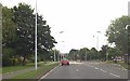
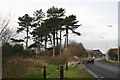
Cycle ways turn left off Larmour Road
Image: © Steve Fareham
Taken: 12 Oct 2015
0.10 miles
6
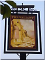
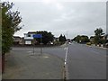
The Valiant Public House, Willows Estate
Pub now closed for business
Image: © CHRISTOPHER DANIEL
Taken: 22 Apr 2011
0.18 miles
7
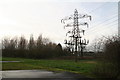
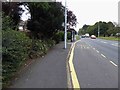
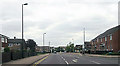
Pylons and pathways next to Great Coates Road
Image: © Chris
Taken: 18 Dec 2013
0.19 miles
9
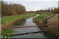
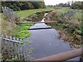
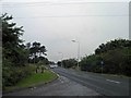
River Freshney at Great Coates Road, looking northwards
Image: © Chris
Taken: 18 Dec 2013
0.21 miles