IMAGES TAKEN NEAR TO
St. Hildas Avenue, GRIMSBY, DN34 4PF
Introduction
This page details the photographs taken nearby to St. Hildas Avenue, DN34 4PF by members of the Geograph project.
The Geograph project started in 2005 with the aim of publishing, organising and preserving representative images for every square kilometre of Great Britain, Ireland and the Isle of Man.

There are currently over 7.5m images from over14,400 individuals and you can help contribute to the project by visiting https://www.geograph.org.uk
Image Map
Images are licensed for reuse under creativecommons.org/licenses/by-sa/2.0
Notes
- Clicking on the map will re-center to the selected point.
- The higher the marker number, the further away the image location is from the centre of the postcode.
Image Listing (12 Images Found)
Images are licensed for reuse under creativecommons.org/licenses/by-sa/2.0
Image
Details
Distance
1
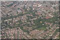
Grimsby Town Centre: aerial 2018 (1)
St. James' School centre right.
Image: © Chris
Taken: 6 Jul 2018
0.13 miles
3
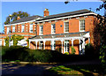
Pelham Road, Grimsby
Field House, formerly the Home of Sir Alec Black, (1873 - 1942) local Trawler Owner and Philanthropist.
http://www.flickr.com/photos/riffraff1/2984300902/
Image: © David Hebb
Taken: 16 Jan 2009
0.15 miles
4
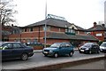
Fieldhouse Medical Centre, Dudley Street
Image: © Allan chapman
Taken: 25 Mar 2008
0.15 miles
5
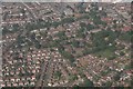
Grimsby Town Centre: aerial 2018 (2)
South of the railway. St. James' School top right.
Image: © Chris
Taken: 6 Jul 2018
0.16 miles
8
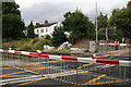
Level crossing on Littlefield Lane, Grimsby
The world waited...and waited...and eventually a train came, and at quite a speed. See: Image
Image: © Chris
Taken: 18 Aug 2014
0.20 miles
9
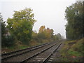
The railway west of Littlefield Lane
Opened by the Manchester, Sheffield and Lincolnshire Railway in 1848. The opening of the railways to Grimsby transformed this, until then, fairly insignificant town into a major fishing and cargo port.
Image: © Jonathan Thacker
Taken: 24 Oct 2012
0.21 miles