IMAGES TAKEN NEAR TO
Ladysmith Road, GRIMSBY, DN32 9EF
Introduction
This page details the photographs taken nearby to Ladysmith Road, DN32 9EF by members of the Geograph project.
The Geograph project started in 2005 with the aim of publishing, organising and preserving representative images for every square kilometre of Great Britain, Ireland and the Isle of Man.

There are currently over 7.5m images from over14,400 individuals and you can help contribute to the project by visiting https://www.geograph.org.uk
Image Map
Images are licensed for reuse under creativecommons.org/licenses/by-sa/2.0
Notes
- Clicking on the map will re-center to the selected point.
- The higher the marker number, the further away the image location is from the centre of the postcode.
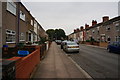
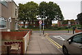
Image Listing (29 Images Found)
Images are licensed for reuse under creativecommons.org/licenses/by-sa/2.0
Image
Details
Distance
1
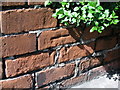
Cut Mark: Grimsby, 15/17 Durban Road
A weathered mark on the front of the gardens' wall. See http://www.bench-marks.org.uk/bm42811 for details.
Image: © Brian Westlake
Taken: 30 Apr 2012
0.09 miles
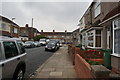
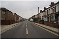
3
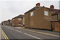
Convamore Road towards Sixhills Street, Grimsby
Image: © Ian S
Taken: 5 Sep 2014
0.10 miles
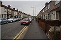
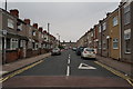
9
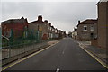
Sixhills Street towards Edwards Street, Grimsby
Image: © Ian S
Taken: 5 Sep 2014
0.13 miles