
IMAGES TAKEN NEAR TO
Heneage Road, GRIMSBY, DN32 9AH
Introduction
This page details the photographs taken nearby to Heneage Road, DN32 9AH by members of the Geograph project.
The Geograph project started in 2005 with the aim of publishing, organising and preserving representative images for every square kilometre of Great Britain, Ireland and the Isle of Man.

There are currently over 7.5m images from over14,400 individuals and you can help contribute to the project by visiting https://www.geograph.org.uk
Image Map
Images are licensed for reuse under creativecommons.org/licenses/by-sa/2.0
Notes
- Clicking on the map will re-center to the selected point.
- The higher the marker number, the further away the image location is from the centre of the postcode.
Image Listing (71 Images Found)
Images are licensed for reuse under creativecommons.org/licenses/by-sa/2.0
Image
Details
Distance
1
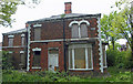
Derelict House, Heneage Road, Grimsby
A solidly built Victorian villa on the corner of Heneage Road and Eleanor Street which has been allowed to fall into wrack and ruin.
Image: © David Wright
Taken: 14 May 2010
0.02 miles
2
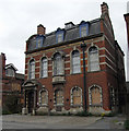
Derelict Education Department Offices, Grimsby
This listed building is one of an extensive range of derelict buildings on Eleanor Street. For the English Heritage listing record see http://www.imagesofengland.org.uk/details/default.aspx?id=479266
Image: © David Wright
Taken: 29 Apr 2010
0.04 miles
3
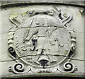
Grimsby Civic Badge, Eleanor Road
One hundred years of acid rain have taken their toll on this civic badge on the front of the former Education Department offices Image There is a better preserved example on the old Board School tower in nearby Heneage Road Image The image is based on the ancient "Sigellum comunitatis Grimebye" (Civic seal of Grimsby) and depicts the legendary Gryem together with Habloc and Goldeburgh.
Image: © David Wright
Taken: 14 May 2010
0.05 miles
4
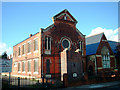
Grimsby Synagogue
Sir Moses Montefiore Synagogue, Heneage Road, Grimsby. (B.S. Jacobs, 1885-8. Mikveh 1915-16). Listed Grade II. The Synagogue is situated on Heneage Road immediately South of the Board School Image
Image: © David Wright
Taken: 21 Oct 2006
0.05 miles
5
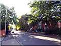
Heneage Road
Picture taken from a position close to St. Mary's RC Church looking South.
Image: © David Wright
Taken: 21 Oct 2006
0.05 miles
6
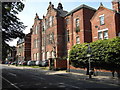
The Old Art College, Eleanor Street
I believe this was the Art College, now derelict, and will probably go the same way as most other disused buildings: arson.
Image: © Robert Reynolds
Taken: 10 Aug 2007
0.05 miles
7
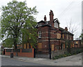
"Farnhurst" 5 Eleanor Street, Grimsby
Former resource centre offering care for people under 65 with a learning disability who needed a secure environment and help with day to day living. Now boarded-up and apparently likely to join the extensive range of derelict local authority buildings on this part of Eleanor Street Image] Image
Image: © David Wright
Taken: 29 Apr 2010
0.05 miles
8
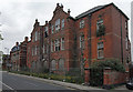
Derelict Art School, Eleanor Road, Grimsby
A solid Victorian building which has been allowed to fall into state of dereliction.
Image: © David Wright
Taken: 29 Apr 2010
0.06 miles
9
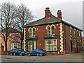
Dental Surgery, 7 Hainton Avenue, Grimsby
Image: © David Wright
Taken: 25 Feb 2008
0.06 miles
10
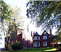
St. Mary's By The Sea Church
St. Mary's By The Sea RC church and Presbytery, Heneage Road. 1879-1883 by Hadfield & Son. Both buildings are listed Grade II.
Image: © David Wright
Taken: 21 Oct 2006
0.07 miles