IMAGES TAKEN NEAR TO
Annesley Street, GRIMSBY, DN31 1XB

Introduction

This page details the photographs taken nearby to Annesley Street, DN31 1XB by members of the Geograph project.

The Geograph project started in 2005 with the aim of publishing, organising and preserving representative images for every square kilometre of Great Britain, Ireland and the Isle of Man.

There are currently over 7.5m images from over14,400 individuals and you can help contribute to the project by visiting https://www.geograph.org.uk

Image Map


Images are licensed for reuse under creativecommons.org/licenses/by-sa/2.0
Notes
  • Clicking on the map will re-center to the selected point.
  • The higher the marker number, the further away the image location is from the centre of the postcode.

Image Listing (52 Images Found)

Images are licensed for reuse under creativecommons.org/licenses/by-sa/2.0
  • ...
Image
Details
Distance
1
Westgate in Grimsby
Image: © Steve Daniels Taken: 16 May 2016
0.07 miles
2
Westgate heading east towards Grimsby
Image: © JThomas Taken: 29 Dec 2011
0.10 miles
3
Alexandra retail park Grimsby
Including a now departed Comet shop.
Image: © Steve Fareham Taken: 12 Jan 2013
0.11 miles
4
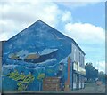
Fishery-themed street art, Corporation Road, Grimsby
Corner of Rendle Street.
Image: © Chris Taken: 18 Sep 2023
0.13 miles
5
Retail park, Grimsby
Image: © Chris Morgan Taken: 25 Apr 2017
0.13 miles
6
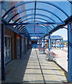
Arcade, Alexandra Dock Retail Park
Image: © David Wright Taken: 4 Jun 2010
0.14 miles
7
Entrance to the Alexandra Dock Retail Park
Image: © David Wright Taken: 8 Aug 2008
0.14 miles
8
Corporation Road, Grimsby
The New West Marsh Club, is an early Edwardian example of The Working Men's Club with Dentile Cornice and Gables it was built in 1902.
Image: © David Hebb Taken: 29 Mar 2008
0.14 miles
9
Alexandra Dock retail park
Matalan store from car park
Image: © John Firth Taken: 14 Jun 2012
0.15 miles
10
Retail Park, Grimsby
Image: © Chris Morgan Taken: 25 Apr 2017
0.15 miles
  • ...