
IMAGES TAKEN NEAR TO
Church Lane, RETFORD, DN22 9LD
Introduction
This page details the photographs taken nearby to Church Lane, DN22 9LD by members of the Geograph project.
The Geograph project started in 2005 with the aim of publishing, organising and preserving representative images for every square kilometre of Great Britain, Ireland and the Isle of Man.

There are currently over 7.5m images from over14,400 individuals and you can help contribute to the project by visiting https://www.geograph.org.uk
Image Map
Images are licensed for reuse under creativecommons.org/licenses/by-sa/2.0
Notes
- Clicking on the map will re-center to the selected point.
- The higher the marker number, the further away the image location is from the centre of the postcode.
Image Listing (86 Images Found)
Images are licensed for reuse under creativecommons.org/licenses/by-sa/2.0
Image
Details
Distance
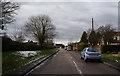
2
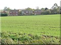
Houses in Church Lane, Clarborough
Seen from the Chesterfield Canal.
Image: © Christine Johnstone
Taken: 14 Oct 2011
0.04 miles
3
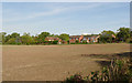
View from Church Lane, Hayton
Modern housing on the western side of the village.
Image: © Alan Murray-Rust
Taken: 5 Oct 2014
0.04 miles
4
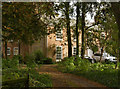
The Old Vicarage, Hayton
Built in the 18th century, with 19th century additions. Listed Grade II.
Image: © Alan Murray-Rust
Taken: 5 Oct 2014
0.06 miles
5
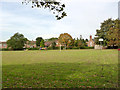
Hayton Recreation Ground
Looking towards Church Lane.
Image: © Alan Murray-Rust
Taken: 5 Oct 2014
0.06 miles
6
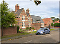
Former village school and school house, Hayton
The house is now a private house, the school now serving as the village hall. A nice example of polychrome brickwork.
Image: © Alan Murray-Rust
Taken: 5 Oct 2014
0.07 miles
9

When did you last Survey your Ordinances?
Detail of the local Parish Footpaths map http://www.geograph.org.uk/photo/4197376 with, sadly, several spelling errors. It's also unfortunate that the symbols for footpaths and bridleways are the reverse of the conventional symbols on Ordnance Survey maps.
Image: © Alan Murray-Rust
Taken: 5 Oct 2014
0.08 miles
10
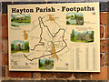
Hayton Parish Footpaths map
An attractive presentation, although less useful than it might be for not having a more detailed mapping base to show the relationship of paths to features on the ground.
Image: © Alan Murray-Rust
Taken: 5 Oct 2014
0.08 miles