IMAGES TAKEN NEAR TO
North Road, RETFORD, DN22 7XF
Introduction
This page details the photographs taken nearby to North Road, DN22 7XF by members of the Geograph project.
The Geograph project started in 2005 with the aim of publishing, organising and preserving representative images for every square kilometre of Great Britain, Ireland and the Isle of Man.

There are currently over 7.5m images from over14,400 individuals and you can help contribute to the project by visiting https://www.geograph.org.uk
Image Map
Images are licensed for reuse under creativecommons.org/licenses/by-sa/2.0
Notes
- Clicking on the map will re-center to the selected point.
- The higher the marker number, the further away the image location is from the centre of the postcode.
Image Listing (93 Images Found)
Images are licensed for reuse under creativecommons.org/licenses/by-sa/2.0
Image
Details
Distance
1
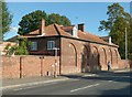
Former stable block, West Retford House
Not to be confused with West Retford Hall. 18th century brick stable block, not converted to Hotel accommodation. Listed Grade II.
Image: © Alan Murray-Rust
Taken: 11 Oct 2015
0.02 miles
2
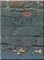
Bench mark, 31 North Road
Not easy to spot in the shadow on a wall blackened by road grime.
Image: © Alan Murray-Rust
Taken: 11 Oct 2015
0.02 miles
3
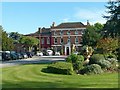
West Retford House
Late 18th century Georgian house with later additions and alterations. Now a hotel. Listed Grade II.
Image: © Alan Murray-Rust
Taken: 11 Oct 2015
0.04 miles
4
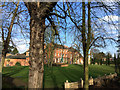
West Retford Hotel
The rear of the hotel seen from close to its sunken garden.
Image: © John Allan
Taken: 5 Feb 2017
0.04 miles
5
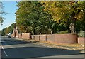
North Road with the wall of West Retford House
There are the remains of a bench mark http://www.geograph.org.uk/photo/4700539 on the wall right of centre where the newer section starts.
Image: © Alan Murray-Rust
Taken: 11 Oct 2015
0.06 miles
6
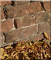
Bench mark, North Road
Virtually indecipherable due to the erosion of the brickwork. See http://www.geograph.org.uk/photo/4700541 for location.
Image: © Alan Murray-Rust
Taken: 11 Oct 2015
0.06 miles
7
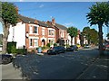
Villas on Lime Tree Avenue
Built in the early years of the 20th century for prosperous merchants and the like, most to the designs of local architects Eyre and Southall.
Image: © Alan Murray-Rust
Taken: 11 Oct 2015
0.06 miles
8
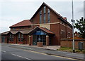
Retford Baptist Church and Community Centre
A modern church complex by the A620, Hospital Road, near the busy roundabout.
Image: © Andrew Hill
Taken: 14 Jul 2010
0.10 miles
9
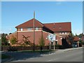
The Well, Retford Baptist Church
This was opened in around 2010 replacing an older chapel.
Image: © Alan Murray-Rust
Taken: 11 Oct 2015
0.10 miles