IMAGES TAKEN NEAR TO
Longholme Road, RETFORD, DN22 6TU
Introduction
This page details the photographs taken nearby to Longholme Road, DN22 6TU by members of the Geograph project.
The Geograph project started in 2005 with the aim of publishing, organising and preserving representative images for every square kilometre of Great Britain, Ireland and the Isle of Man.

There are currently over 7.5m images from over14,400 individuals and you can help contribute to the project by visiting https://www.geograph.org.uk
Image Map
Images are licensed for reuse under creativecommons.org/licenses/by-sa/2.0
Notes
- Clicking on the map will re-center to the selected point.
- The higher the marker number, the further away the image location is from the centre of the postcode.
Image Listing (44 Images Found)
Images are licensed for reuse under creativecommons.org/licenses/by-sa/2.0
Image
Details
Distance
1
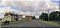
Line of trees near the Chesterfield Canal
Mark the line of a footpath.
Image: © Jonathan Thacker
Taken: 24 Nov 2016
0.08 miles
2
Tending to the market garden at dusk
This large vegetable plot is between Welham Road and the Chesterfield Canal, opposite the Hop Pole pub. The hard-woring man never even noticed the boat go by.
Image: © Christine Johnstone
Taken: 13 Oct 2011
0.08 miles
4
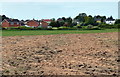
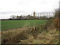
Farmland and houses on the edge of Retford
Image: © Mat Fascione
Taken: 28 May 2016
0.09 miles
7
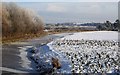
A very cold Chesterfield Canal
Looking east from the bridge near the Hop Pole Pub
Image: © roger geach
Taken: 28 Nov 2010
0.09 miles
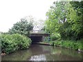
8
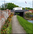
Hop Pole Bridge No 59
Carrying Welham Road across the Chesterfield Canal on the edge of Retford.
Image: © Mat Fascione
Taken: 28 May 2016
0.09 miles
9
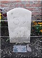
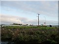
Canal Milemarker by the Chesterfield Canal, Retford
Modern milemarker by the Chesterfield Canal, in parish of East Retford (Bassetlaw District), South of bridge 59 (A620 road), opposite Hop Pole PH.
Inscription reads:-
32
(plus commemorative plaque)
Surveyed
Milestone Society National ID: CHE-32
Image: © Milestone Society
Taken: Unknown
0.10 miles
10
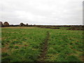
Footpath to Hayton
This path generally keeps to the east side of the field. Officially it runs through the middle of the field but this route is prone to waterlogging.
Image: © Jonathan Thacker
Taken: 24 Nov 2016
0.10 miles