
IMAGES TAKEN NEAR TO
King Street, GAINSBOROUGH, DN21 1JS
Introduction
This page details the photographs taken nearby to King Street, DN21 1JS by members of the Geograph project.
The Geograph project started in 2005 with the aim of publishing, organising and preserving representative images for every square kilometre of Great Britain, Ireland and the Isle of Man.

There are currently over 7.5m images from over14,400 individuals and you can help contribute to the project by visiting https://www.geograph.org.uk
Image Map
Images are licensed for reuse under creativecommons.org/licenses/by-sa/2.0
Notes
- Clicking on the map will re-center to the selected point.
- The higher the marker number, the further away the image location is from the centre of the postcode.
Image Listing (112 Images Found)
Images are licensed for reuse under creativecommons.org/licenses/by-sa/2.0
Image
Details
Distance
2
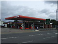
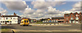
Service station on Bridge Road, Gainsborough
Image: © JThomas
Taken: 1 Sep 2012
0.04 miles
3
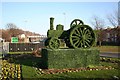
Gainsborough topiary
Clever topiary on Thorndike Way roundabout recognising Gainsborough's engineering past
Image: © Richard Croft
Taken: 11 Feb 2008
0.05 miles
5
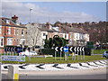
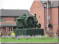
Roundabout Topiary - Junction A631 & Trinity Street
Taken from the car park of Papa's Fish restaurant, The picture shows a depiction in topiary of a traction engine similar to those originally constructed at Marshall's Yard in the early 20th century. Not sure if the 'hedge' is live or a 'faux' version as I have not seen anyone actually trimming it.
Image: © John Bell
Taken: 27 Mar 2010
0.06 miles
9
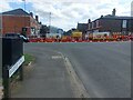
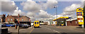
Road works, Lea Road, Gainsborough
Lea Road is closed at its junction with Bridge Road while excavations take place.
Image: © Graham Robson
Taken: 9 Jul 2023
0.07 miles
10

Cut Bench Mark near Gainsborough Bridge
This cut bench mark dates from the mid nineteenth century First Geodetic Levelling of England Wales and is a mark on the London to Doncaster levelling line. See https://www.geograph.org.uk/photo/6897559 for a wider view and https://www.bench-marks.org.uk/bm30201 for details of the mark.
Image: © Brian Westlake
Taken: 8 Jul 2021
0.07 miles