
IMAGES TAKEN NEAR TO
Winston Way, BRIGG, DN20 8UA
Introduction
This page details the photographs taken nearby to Winston Way, DN20 8UA by members of the Geograph project.
The Geograph project started in 2005 with the aim of publishing, organising and preserving representative images for every square kilometre of Great Britain, Ireland and the Isle of Man.

There are currently over 7.5m images from over14,400 individuals and you can help contribute to the project by visiting https://www.geograph.org.uk
Image Map
Images are licensed for reuse under creativecommons.org/licenses/by-sa/2.0
Notes
- Clicking on the map will re-center to the selected point.
- The higher the marker number, the further away the image location is from the centre of the postcode.
Image Listing (16 Images Found)
Images are licensed for reuse under creativecommons.org/licenses/by-sa/2.0
Image
Details
Distance
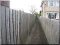
2
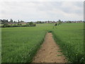
View towards Brigg
Nothing special to see just suburban housing. Taken from the footpath from Kettleby.
Image: © Jonathan Thacker
Taken: 21 May 2016
0.16 miles
5
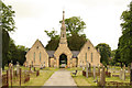
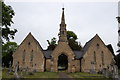
Cemetery Chapels
19th century cemetery chapels in Wrawby Road cemetery
Image: © Richard Croft
Taken: 8 Jun 2013
0.21 miles
7
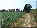
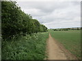
Rural Fringe of Brigg
This picture was taken from the public footpath which runs from the end of St. Helen's Road to Kettleby Lane. The houses are on the eastern side of Churchill Avenue and the field is a prime prospect as building land if Brigg expands to the East.
Image: © David Wright
Taken: 17 Jul 2006
0.22 miles
8
View towards St. Helen's Well
The dedication of wells to St. Helen was common in parts of England in the Middle Ages. Most were associated with healing. This well has been covered (perhaps in the nineteenth century).
Image: © Jonathan Thacker
Taken: 21 May 2016
0.22 miles
9
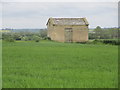
St. Helen's Well
The dedication of wells to St. Helen was common in parts of England in the Middle Ages. Most were associated with healing. This well has been covered (perhaps in the nineteenth century).
Image: © Jonathan Thacker
Taken: 21 May 2016
0.23 miles
10
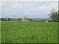
St. Helen's Well
The dedication of wells to St. Helen was common in parts of England in the Middle Ages. Most were associated with healing. This well has been covered (perhaps in the nineteenth century).
Image: © Jonathan Thacker
Taken: 21 May 2016
0.23 miles