IMAGES TAKEN NEAR TO
Halton Villas, Barrow Road, BARROW-UPON-HUMBER, DN19 7QS

Introduction

This page details the photographs taken nearby to Halton Villas, Barrow Road, DN19 7QS by members of the Geograph project.

The Geograph project started in 2005 with the aim of publishing, organising and preserving representative images for every square kilometre of Great Britain, Ireland and the Isle of Man.

There are currently over 7.5m images from over14,400 individuals and you can help contribute to the project by visiting https://www.geograph.org.uk

Image Map


Images are licensed for reuse under creativecommons.org/licenses/by-sa/2.0
Notes
  • Clicking on the map will re-center to the selected point.
  • The higher the marker number, the further away the image location is from the centre of the postcode.

Image Listing (102 Images Found)

Images are licensed for reuse under creativecommons.org/licenses/by-sa/2.0
  • ...
Image
Details
Distance
1
Victorian Terrace, Barrow Road, New Holland
Image: © David Wright Taken: 2 Aug 2009
0.00 miles
2
Line of feature windows in Barrow Road
See: https://web.archive.org/web/20120422105623/http://www.pluralist.freeuk.com/newholl/history.html
Image: © Chris Taken: 22 Jun 2013
0.02 miles
3
Barrow Road from Albert Street junction
Image: © John Firth Taken: 10 Jun 2013
0.03 miles
4
Alma Villas, Barrow Road, New Holland
Alma Villas are dated 1887.
Image: © David Wright Taken: 7 Sep 2009
0.03 miles
5
New Holland, Lincolnshire
The former Co-op Society building, now a restaurant.http://www.flickr.com/photos/riffraff1/660622218/in/set-72157594421287329
Image: © David Hebb Taken: 2 Oct 2008
0.03 miles
6
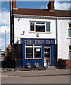
The Fish Pan, New Holland
The Fish Pan, New Holland, North Lincolnshire.
Image: © David Wright Taken: 17 Apr 2006
0.03 miles
7
New Holland - Methodist Church
The front of the building bears an inscription "Primitive Methodist 1877".
Image: © David Wright Taken: 17 Apr 2006
0.04 miles
8
Temperance Villas
This appropriately named line of cottages once adjoined the Primitive Methodist Chapel, but the end section has been demolished, or perhaps destroyed by bombing in WW2? https://web.archive.org/web/20120422105623/http://www.pluralist.freeuk.com/newholl/history.html
Image: © Chris Taken: 22 Jun 2013
0.04 miles
9
Fire Damage - Barrow Road, New Holland
Fire damage to terraced houses on Barrow Road.
Image: © David Wright Taken: 19 Jan 2010
0.05 miles
10
Primitive Methodist Chapel 1877
A sad sight in 2013, with its blackened date stone and boarded up doors and windows. See: https://web.archive.org/web/20120422105623/http://www.pluralist.freeuk.com/newholl/history.html
Image: © Chris Taken: 22 Jun 2013
0.06 miles
  • ...