1
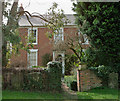
The Old Vicarage, Barrow Upon Humber
Picture taken from the churchyard of Holy Trinity.
Image: © David Wright
Taken: 9 Apr 2010
0.02 miles
2
Thorngarth Lane, Barrow Upon Humber
The brick wall to the left of the picture marks the frontage of Gooseman's Yard.
Image: © David Wright
Taken: 8 Jan 2009
0.02 miles
3
Thorngarth Lane, Barrow Upon Humber
Image: © David Wright
Taken: 8 Jan 2009
0.03 miles
4
Footpath through Barrow Churchyard
Image: © David Wright
Taken: 2 Jul 2009
0.03 miles
5
The Old Vicarage, Barrow Upon Humber
Image: © David Wright
Taken: 9 Apr 2010
0.03 miles
6
OS Bench Marks, Holy Trinity Church, Barrow Upon Humber
This bench mark height is 47.5570 feet [14.4954 metres] above mean sea level (Liverpool datum). The mark is one of a number of marks levelled during 1851-1857 on a survey line from Swineshead to Rawcliffe and is described as Bolt in North-west angle of Barrow Church tower ; 3.57 ft. above surface [1GL, Swineshead to Rawcliffe, Mark No. 195], with additional information available, on the Bench Mark Database at http://www.bench-marks.org.uk/bm23966. Other nearby marks on the levelling line are described in the Ordnance Survey abstract at http://www.deformedweb.co.uk/trigs/data/1GL/1GLA_296.png.
Image: © David Wright
Taken: 9 Apr 2010
0.03 miles
7
Barrow upon Humber, Church
The buttress just in view at the right of the tower carries a bolt and cut bench mark dating from an Ordnance Survey levelling of the 1850s. See http://www.geograph.org.uk/photo/5163253 for a close-up and http://www.bench-marks.org.uk/bm23966 for details of the mark.
Image: © Brian Westlake
Taken: 20 Oct 2016
0.03 miles
8
1GL Bolt: Barrow upon Humber, Church
The bolt and cut bench mark dating from an Ordnance Survey levelling of the 1850s on a buttress at the north-west angle of the tower. See http://www.geograph.org.uk/photo/5163250 for a wider view and http://www.bench-marks.org.uk/bm23966 for details of the mark.
Image: © Brian Westlake
Taken: 20 Oct 2016
0.03 miles
9
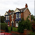
Ivy Dene
Ivy Dene situated on North Street is a good example of Victorian domestic architecture which appears to have escaped "improvement".
Image: © David Wright
Taken: 27 Sep 2006
0.04 miles
10
The Corner of Thorngarth Lane and North Street
The corner of Thorngarth Lane (left) and North Street (right).
Image: © David Wright
Taken: 8 Jan 2009
0.04 miles


