IMAGES TAKEN NEAR TO
Low Street, BARTON-UPON-HUMBER, DN18 6HQ
Introduction
This page details the photographs taken nearby to Low Street, DN18 6HQ by members of the Geograph project.
The Geograph project started in 2005 with the aim of publishing, organising and preserving representative images for every square kilometre of Great Britain, Ireland and the Isle of Man.

There are currently over 7.5m images from over14,400 individuals and you can help contribute to the project by visiting https://www.geograph.org.uk
Image Map
Images are licensed for reuse under creativecommons.org/licenses/by-sa/2.0
Notes
- Clicking on the map will re-center to the selected point.
- The higher the marker number, the further away the image location is from the centre of the postcode.
Image Listing (159 Images Found)
Images are licensed for reuse under creativecommons.org/licenses/by-sa/2.0
Image
Details
Distance

2

Abstainers Cottage on Low Street
Just across the road from the Nelthorpe Arms, South Ferriby.
Image: © Ian S
Taken: 25 Jun 2014
0.02 miles
3
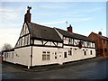
The Nelthorpe Arms
Open according to its website, closed by order of the Parish Council according to a notice in a window.
Image: © Graham Hogg
Taken: 24 Jan 2017
0.03 miles
4
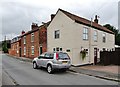
Low Street, South Ferriby, Lincolnshire
The former primary school, Fuchsia Cottage, End Cottage and Abstainers Cottage. The curiously-named latter is probably named after the Abstainers' Hall that was just to the west of the cottage, extant by 1887. The Hall was undoubtedly linked to the temperance movement that originated in the 19th century.
Image: © Bernard Sharp
Taken: 30 Jun 2017
0.03 miles
5
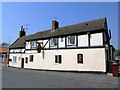
The Nelthorpe Arms
The Nelthorpe Arms, South Ferriby, North Lincolnshire.
Image: © David Wright
Taken: 9 May 2006
0.04 miles
6
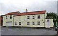
Old Post Office Lane, South Ferriby, Lincolnshire
The Old Post House, once the location of the village post office, now a dwelling.
Image: © Bernard Sharp
Taken: 30 Jun 2017
0.04 miles
7
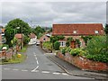
Skinners Lane, South Ferriby, Lincolnshire
Looking along the lane from High Street, with The White House, south side, and Bramble Cottage, north side.
Image: © Bernard Sharp
Taken: 30 Jun 2017
0.04 miles
8
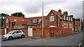
School Lane, South Ferriby, Lincolnshire
The former Elementary School (mixed) was rebuilt and enlarged in 1872, catering for 180 children. The school closed in 2005. Approval was granted in 2009 to convert the redundant building into three residential units. They are known as 'The Old School Library', 'The Old School Hall' and 'The Old School'.
Image: © Bernard Sharp
Taken: 30 Jun 2017
0.04 miles