School Lane, South Ferriby, Lincolnshire
Introduction
The photograph on this page of School Lane, South Ferriby, Lincolnshire by Bernard Sharp as part of the Geograph project.
The Geograph project started in 2005 with the aim of publishing, organising and preserving representative images for every square kilometre of Great Britain, Ireland and the Isle of Man.

There are currently over 7.5m images from over 14,400 individuals and you can help contribute to the project by visiting https://www.geograph.org.uk
School Lane, South Ferriby, Lincolnshire
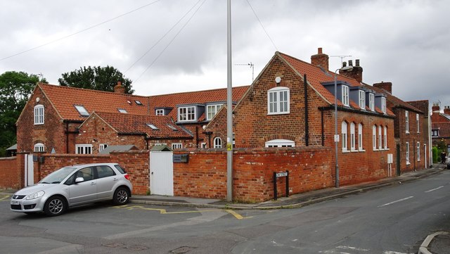
Image: © Bernard Sharp Taken: 30 Jun 2017
The former Elementary School (mixed) was rebuilt and enlarged in 1872, catering for 180 children. The school closed in 2005. Approval was granted in 2009 to convert the redundant building into three residential units. They are known as 'The Old School Library', 'The Old School Hall' and 'The Old School'.
Images are licensed for reuse under creativecommons.org/licenses/by-sa/2.0
Image Location
Latitude
53.675092
Longitude
-0.508409