
IMAGES TAKEN NEAR TO
Warblers Close, BARTON-UPON-HUMBER, DN18 5BY
Introduction
This page details the photographs taken nearby to Warblers Close, DN18 5BY by members of the Geograph project.
The Geograph project started in 2005 with the aim of publishing, organising and preserving representative images for every square kilometre of Great Britain, Ireland and the Isle of Man.

There are currently over 7.5m images from over14,400 individuals and you can help contribute to the project by visiting https://www.geograph.org.uk
Image Map
Images are licensed for reuse under creativecommons.org/licenses/by-sa/2.0
Notes
- Clicking on the map will re-center to the selected point.
- The higher the marker number, the further away the image location is from the centre of the postcode.
Image Listing (62 Images Found)
Images are licensed for reuse under creativecommons.org/licenses/by-sa/2.0
Image
Details
Distance
1
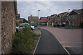
Rambler's Lane, Barton upon Humber
Part of the recent Keigar Homes development off Dam Road
Image: © Paul Harrop
Taken: 30 Aug 2008
0.05 miles
2
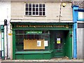
Barton Regeneration Centre
Barton Regeneration Centre, Fleetgate, Barton-Upon-Humber, North Lincolnshire.
Image: © David Wright
Taken: 11 Nov 2004
0.05 miles
3
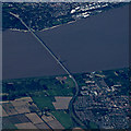
The Humber Bridge from the air
Viewed through a break in the cloud from a Prague bound flight from Glasgow. According to flight tracking records, the aircraft was approximately above Hibaldstow at the time, had just reached cruising altitude of 37,000 feet and was travelling at an equivalent ground speed of 536 miles per hour.
Image: © Thomas Nugent
Taken: 31 Jul 2017
0.05 miles
4
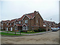
New Housing Development, Barton Upon Humber
Picture shows housing on Dam Road at the corner of newly built Ramblers Lane.
Image: © David Wright
Taken: 26 Nov 2007
0.06 miles
5
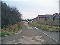
Dam Road, Barton Upon Humber
Note the new Keigar housing development to the South of Dam Road (right of picture). All this low-lying area is coloured Blue on the Environment Agency Flood Map.
Image: © David Wright
Taken: 26 Nov 2007
0.08 miles
6

No Through Road, Barton Upon Humber
Photo shows Dam Road which is now truncated at this point by the embankment carrying the A15 Humber Bridge approach.
Image: © David Wright
Taken: 26 Nov 2007
0.09 miles
7
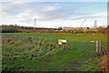
Hunt Charity Recreation Ground
This playground, for children under 12, is situated on Dam Road.
Image: © David Wright
Taken: 10 Dec 2008
0.11 miles
8
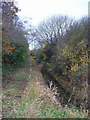
Drain to the North of Dam Road, Barton Upon Humber
The land on both sides of Dam Road at this point is very low lying but this has not deterred the construction of new residential housing in this vicinity Image
Image: © David Wright
Taken: 26 Nov 2007
0.12 miles
9
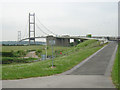
Humber Bridge from South
An interesting and bracing walk from nowhere to nowhere across a world-class suspension bridge over a gloomy estuary with a dismal record of suicide attempts
Image: © David Hignett
Taken: 4 Jun 2003
0.14 miles
10
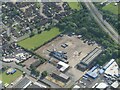
Drilling site (?) by Dam Road, Barton Upon Humber: aerial 2024
Image: © Simon Tomson
Taken: 22 Jun 2024
0.14 miles