The Humber Bridge from the air
Introduction
The photograph on this page of The Humber Bridge from the air by Thomas Nugent as part of the Geograph project.
The Geograph project started in 2005 with the aim of publishing, organising and preserving representative images for every square kilometre of Great Britain, Ireland and the Isle of Man.

There are currently over 7.5m images from over 14,400 individuals and you can help contribute to the project by visiting https://www.geograph.org.uk
The Humber Bridge from the air
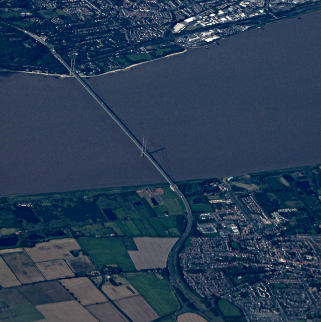
Image: © Thomas Nugent Taken: 31 Jul 2017
Viewed through a break in the cloud from a Prague bound flight from Glasgow. According to flight tracking records, the aircraft was approximately above Hibaldstow at the time, had just reached cruising altitude of 37,000 feet and was travelling at an equivalent ground speed of 536 miles per hour.
Images are licensed for reuse under creativecommons.org/licenses/by-sa/2.0
Image Location
Latitude
53.688903
Longitude
-0.449313