IMAGES TAKEN NEAR TO
Messingham, SCUNTHORPE, DN17 3PR
Introduction
This page details the photographs taken nearby to DN17 3PR by members of the Geograph project.
The Geograph project started in 2005 with the aim of publishing, organising and preserving representative images for every square kilometre of Great Britain, Ireland and the Isle of Man.

There are currently over 7.5m images from over14,400 individuals and you can help contribute to the project by visiting https://www.geograph.org.uk
Image Map (Loading...)


Getting Data...Please wait
Leaflet Map data © OpenStreetMap
Images are licensed for reuse under creativecommons.org/licenses/by-sa/2.0
Notes
- Clicking on the map will re-center to the selected point.
- The higher the marker number, the further away the image location is from the centre of the postcode.
Image Listing (10 Images Found)
Images are licensed for reuse under creativecommons.org/licenses/by-sa/2.0
Image
Details
Distance
1
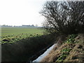
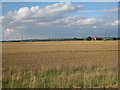
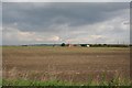
West Common North Drain and Sands Lane Farm
This area is a well drained area of wind blown sand.
Image: © Jonathan Thacker
Taken: 14 Feb 2017
0.01 miles
3
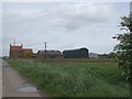
Sand Lane
Looking towards Sand Lane Farm
Image: © Jonathan Thacker
Taken: 31 Jul 2010
0.05 miles
4
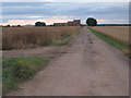
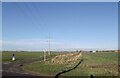
Sand Lane
The track is compacted sand, so is useable at any time of the year. In the distance, heard but not seen, is the M180 motorway.
Image: © Jonathan Billinger
Taken: 31 Jan 2007
0.08 miles
5
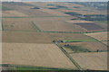
West Common Drain, Trippling Hows, Bottesford Beck: aerial 2007
Between East Butterwick and Messingham.
West Common North Drain runs right-left (bushes along it) above the airstrip, which is in Sand Lane.
Trippling Hows top right, with Bottesford Beck (also running right-left) across the top of it.
Image: © Chris
Taken: 5 Aug 2007
0.11 miles
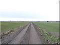
8
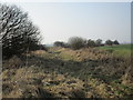
Approaching the bend on West Common North Road
At this point Road is an exaggeration but this is a well used footpath.
Image: © Jonathan Thacker
Taken: 14 Feb 2017
0.18 miles
9
Messingham Common
View towards Sand Lane Farm from West Grange on Messingham Common
Image: © Richard Croft
Taken: 2 Oct 2006
0.19 miles
10
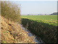
West Common North Drain
Looking towards the Lower Jurassic Ridge on which stands Messingham.
Image: © Jonathan Thacker
Taken: 14 Feb 2017
0.24 miles