IMAGES TAKEN NEAR TO
Corncrake Drive, SCUNTHORPE, DN16 3AJ
Introduction
This page details the photographs taken nearby to Corncrake Drive, DN16 3AJ by members of the Geograph project.
The Geograph project started in 2005 with the aim of publishing, organising and preserving representative images for every square kilometre of Great Britain, Ireland and the Isle of Man.

There are currently over 7.5m images from over14,400 individuals and you can help contribute to the project by visiting https://www.geograph.org.uk
Image Map
Images are licensed for reuse under creativecommons.org/licenses/by-sa/2.0
Notes
- Clicking on the map will re-center to the selected point.
- The higher the marker number, the further away the image location is from the centre of the postcode.
Image Listing (37 Images Found)
Images are licensed for reuse under creativecommons.org/licenses/by-sa/2.0
Image
Details
Distance
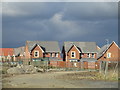
1
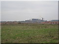
Land waiting to be developed
This land at Brat Hill is waiting to be developed. New estates around Lakeside Parkway can be seen and behind them is the Rolling Mill of Tata Steel.
Image: © Jonathan Thacker
Taken: 2 Mar 2011
0.05 miles
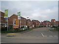
2
New development, Lakeside, Scunthorpe
After something of a lull, work is now proceeding on this new housing estate.
Image: © Jonathan Thacker
Taken: 22 Aug 2012
0.06 miles
3
New housing, Brat Hill
At present the largest expansion of housing in Scunthorpe is in the extreme south-east. Soon there will be a switch to areas to the west of the town as part of the "Lincolnshire Lakes" project.
Image: © Jonathan Thacker
Taken: 1 Mar 2017
0.08 miles
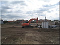
4
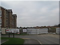
New development, Harpham Close
The land beyond the barrier is being prepared ready for development.
Image: © Jonathan Thacker
Taken: 2 Mar 2011
0.11 miles
6
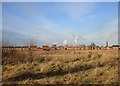
Brat Hill housing
Scunthorpe steelworks in the background showing above the rooftops.
Image: © Jonathan Thacker
Taken: 7 Feb 2018
0.11 miles
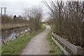
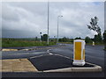
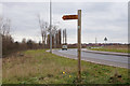
8
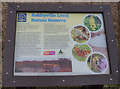
Ashbyville Local Nature Reserve
Taken from the Opencast Way.
Image: © Ian S
Taken: 21 Mar 2016
0.12 miles